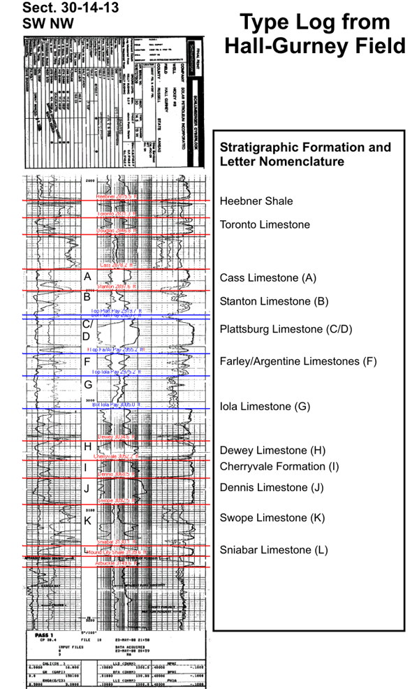
 |
Oomoldic Reservoirs of Central Kansas, Controls on Porosity, Permeability, Capillary Pressure and Architecture |
Kansas Geological Survey Open-file Report 2002-48 |
Hall-Gurney CO2 Demonstration Area
Contour Map Top of Plattsburg - Pay (sub sea)
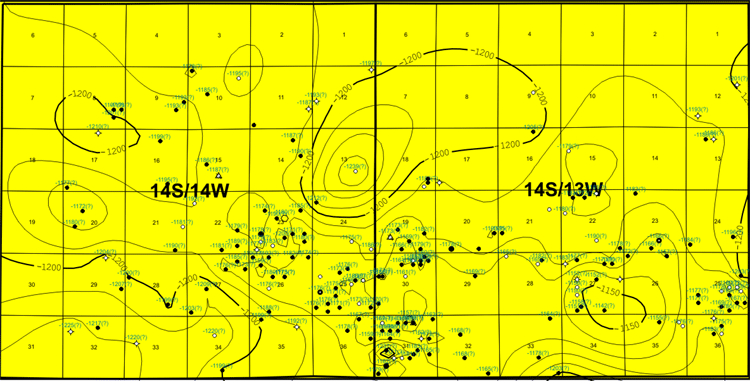
Contour Interval = 10'
Structure contour map depicts the current structural variation in a two township (12 mi x 6 mi, 19 km x 10 km) area around Hall-Gurney Field located in Russell County, Kansas. Primary reservoirs are a stacked oolitic grainstone in the Lansing Group. Field has produced over 154 million barrels of oil since it was discovered in 1931. Today it is the site for a pilot carbon dioxide flood project sponsored by Department of Energy in cooperation with the MV Oil Company.
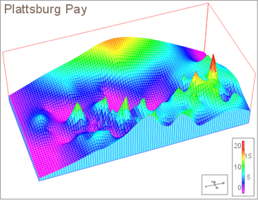
Gross Isopach Map of the Plattsburg Pay
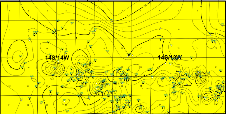
Contour Interval = 2'
The gross isopach map for the Plattsburg Limestone reflects thickness of porous carbonate (primarily oolitic grainstone) that exceeds 17% porosity. The trends on this map parallel current structure. the C/D Plattsburg Limestone is considered to be the best pay due to the greater thickness and spatial extent of higher porosity.
 |
 |
 |
|
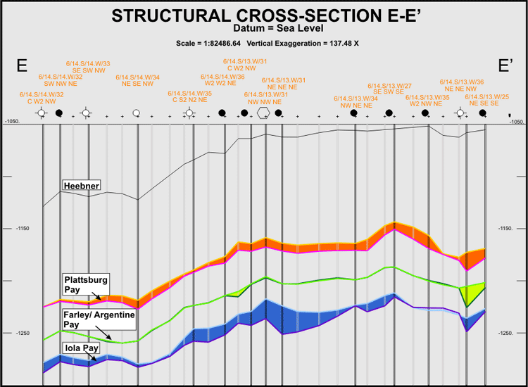
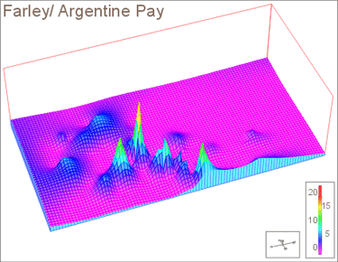
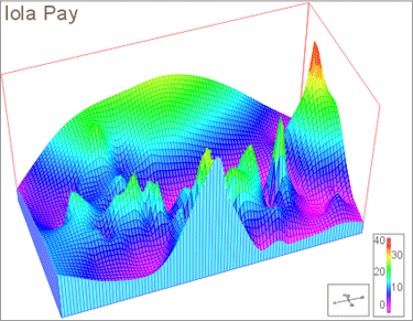
(Note different color scale at Iola Pay)
Vertical Exaggeration : 750 X
|
|
|
e-mail : webadmin@kgs.ku.edu
Last updated March 2004
http://www.kgs.ku.edu/PRS/Poster/2002/2002-48/P2-06.html