
|
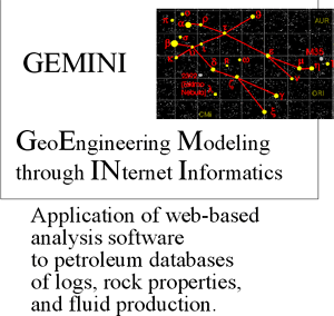
GEMINI
(Geo-Engineering Modeling through INternet Informatics)
|

Kansas Geological Survey
Open-file Report 2002-10 |
Geoinformatics
A. Opportunities in Geoinformatics.
Change exploration and production enterprise by utilization
of large datasets
- provide new insights
- increase competiveness for companies and parties gaining
from resource development
- better descriptive models:
- less interpretation,
- More robust models,
- more predictive and portable models
- quantification of results to increase precision and accuracy
of models and aid in effective design of engineering efforts
B. Issues in Geoinformatics
- Automated integration of disparate datasets Computer-driven
data analysis and integration of results:
- updating files
- printing and downloading “on the fly”
- popular exporting formats and report construction
- Accommodate multiple users
- Security
- Speed in transactions
- Adaptability of system to new hardware and software updates
- User friendly
- Robust - backup and archival support to preserve institutional
knowledge
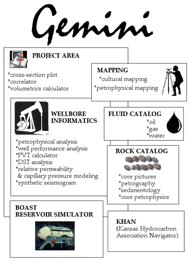
C. Geoinformatics concepts applied specific to GEMINI
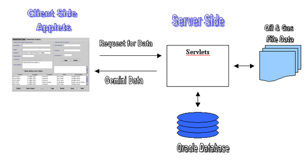
- Well model defined as integrated well log analysis and well
completion data viewed through integrated desktop (user screen
- Java servelets).
- Geo-engineering model as iteratively refined and independently
validated, quantitative description of 3-D reservoir volume (computer-assisted
layering, gridding, volumetrics, and material balance to optimize
simple reservoir characterization and drive mechanism.
- Develop robust input parameters for reservoir simulation
to minimize or limit ad hoc modification of reservoir parameters.
D. Goals of GEMINI Project
- Develop simple validated petrophysical reservoir model.
- Define parameters for fluid flow reservoir simulation.
- Keep mature oil province (Midcontinent) competitive.
E. Engine behind GEMINI
Innovations in technology & refined concepts
- Keep Kansas competitive
- Incubate integrated Entrepreneurial teams
- Optimize time and funds
- Produce quantitative results
- Improve success
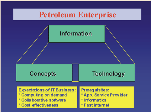
F. General Considerations behind Web-based Application
- Access to information and results (formats, server, network
connectivity, number of users, flexibility, design of upload,
download, and import/export)
- Application development and testing - prototyping involving
geologist, engineer, and programmer
- Software release - follow programming standards for debugging,
“help” documentation, tutorial
- Development - enhancement with additions and upgrading software
and hardware
G. Why Geoinformatics in Reservoir Modeling?
Data bases incomplete and in multiple locations. Limited staff
so data assembly limited
- Poorly known field conditions
- Reservoirs often underproduced
- Common bypassed reservoir layers
- Unknown applications for new technologies
- Characterization is multiscaled problem and interdisciplinary
in nature
- Scales range from pore (type & fabric) to facies, bedding,
structure, and diagenesis (12 orders of magnitude -- see panel
to right)
- Characterization is a 3-D problem
- Defining, correlating, and distributing properties in layers
is multivariate petrophysical and geo-engineering problem
- Validation of petrophysical model a multidisciplined, iterative
approach
- Necessity to keep model simple and accessible vs. no modeling
e-mail : webadmin@kgs.ku.edu
Last updated March 2002
http://www.kgs.ku.edu/PRS/Poster/2002/2002-10/P1-03.html