Arbuckle Reservoirs in Central Kansas: Relative Importance of Depositional Facies, Early Diagenesis and Unconformity Karst Processes on Reservoir Properties
Kansas Geological Survey
Open-file Report 98-55
|
|
Arbuckle Reservoirs in Central Kansas: Relative Importance of Depositional Facies, Early Diagenesis and Unconformity Karst Processes on Reservoir Properties |
Kansas Geological Survey Open-file Report 98-55 |
Arbuckle strata in Kansas are interpreted to have been deposited on a broad shallow shelf in shallow subtidal to peritidal environments, similar to what is recognized in Arbuckle equivalent strata elsewhere in the Midcontinent. The stratigraphic section consists of hundreds of feet of largely dolomitized subtidal to peritidal cyclic carbonates with karst overprinting in the upper portion as a result of prolonged exposure related to the overlying post- Arbuckle (Sauk-Tippecanoe) unconformity.
Karstic processes variously destroyed or enhanced porosity. In some areas karstification significantly enhanced porosity and permeability in a pattern similar to modern karst systems where dissolution follows fracture systems. Whereas much attention has been previously directed at karst features, results from this study indicate that matrix properties may also play an important and even dominant role in some reservoirs. The Arbuckle strata have experienced pervasive but mostly non-fabric destructive dolomitization(s), allowing inference of depositional facies and the paragenetic sequence of events that affected these strata. The striking feature in the cores is the abundance (> 50%) of matrix porosity (intercrystalline, moldic, fenestral, vuggy) throughout the entire lengths of the cores related to depositional facies, early diagenesis, and dolomitization, and unrelated to the post-Arbuckle subaerial exposure surface. Oil stains indicate that these intervals are significant in their potential for storage of fluids and deserve increased attention in exploration and production strategies.
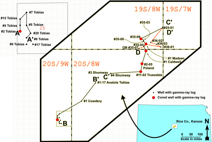 |
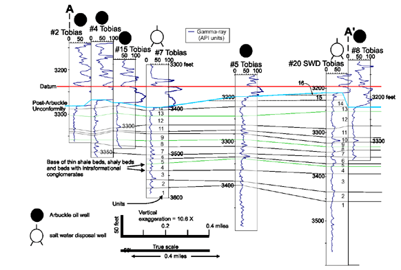
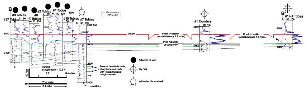
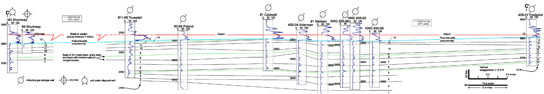
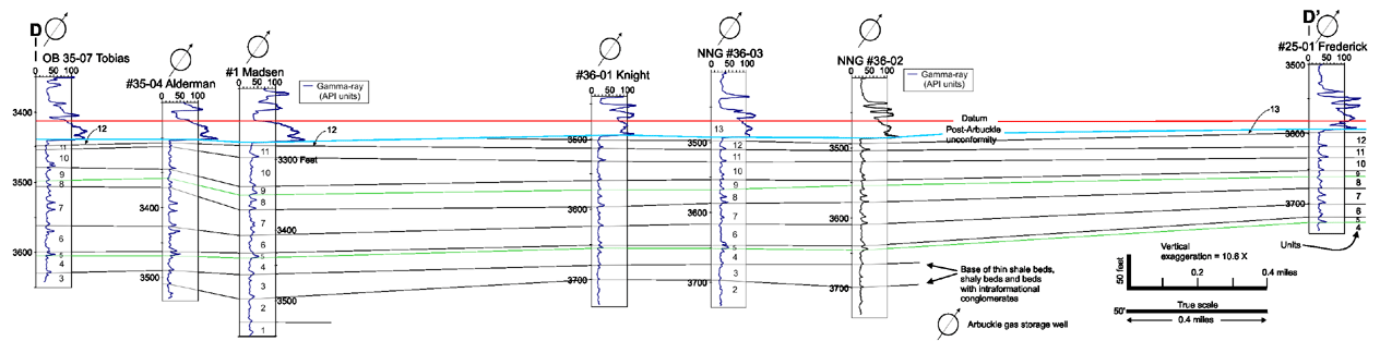
Location map for cross-sections A-A' through D'D' in
Rice County. |
Click on Scroll bar at bottom of your browser to see the right parts of the images below.
Section A - A' |
Section B - B' |
Section C - C' |
Section D-D' |
| Analysis of wire-line logs suggests that key marker beds, including thin shale beds (1 to 5 feet thick), can be correlated over distances of more than ten miles. Cross-sections A-A' through D'D' show correlation of marker beds in central Rice County. Sixteen units are recognized. The uppermost five units are interpreted to be partially or completely truncated by the post-Arbuckle unconformity at many positions across Rice County. Correlations are dashed where less certain. |
|
|
|