
CO2 I Tools
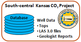
Well Data DB Tables
Wells with Log ASCII Standard (LAS) version 3.0 Files
|
|
CO2 I Tools |
|

 |
Well Header Information Search |
| Applet |
|
||||||||
| ORACLE PL/SQL |
Query for a list of Wells with LAS 3.0 Files in Sumner County http://chasm.kgs.ku.edu/ords/iqstrat.iqstrat_doe_co2_wells_pkg.getWellLAS3XML?sCounty=sumner Returns XML (Extensible Markup Language), which is parsed and well symbols are plotted to a County Map. |
||||||||
| NOTE: |
|
| Author: John R. Victorine jvictor@kgs.ku.edu
The URL for this page is http://www.kgs.ku.edu/PRS/Ozark/JAVA_SRC/ORACLE-I-Files/Well_Data/index.html |
 |
 |