| Kansas Geological Survey Open-File Report |
Index of Images || Small Web Image || Large Web Image || Acrobat PDF (20.1 Megs)
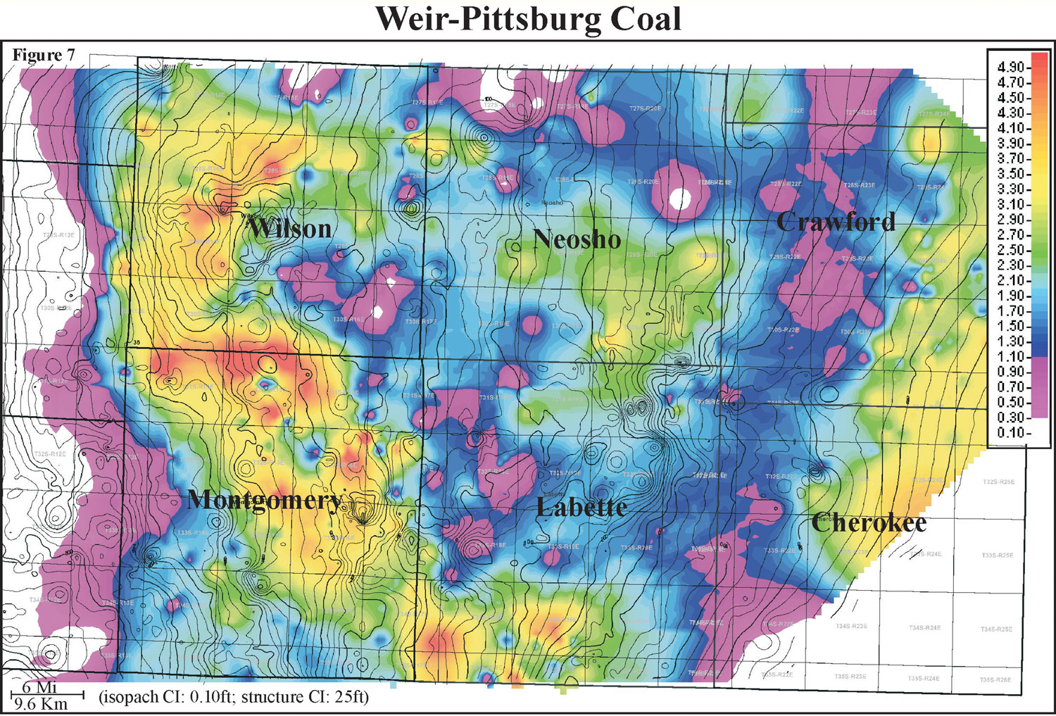
Thickness of the Weir-Pittsburg coal ranges from 0 to 6 feet with an average of 1.5 feet and distribution skewed to the minimum (0 to 1.8 m, average of 0.5 m). Isopach mapping of the Weir-Pittsburg coal reveals a coal that stays fairly consistent in thickness over an average of 2.5 miles (4 km). When overlaying contours of top Mississippian structure, the coal appears to follow the structural strike. The Weir-Pittsburg coal exhibits a lenticular geometry that is oriented parallel to depositional strike, and is consistently thicker through an acute trend from southern Labette through Montgomery and Wilson counties. Localized circular areas of the Weir-Pittsburg coal may be due to removal by fire or crevasse splays.