| Kansas Geological Survey Open-File Report |
Index of Images || Small Web Image || Large Web Image || Acrobat PDF (17.1 Megs)
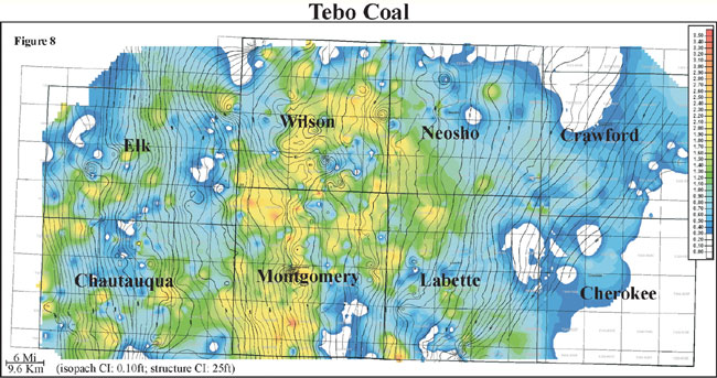
Thickness of the Tebo coal ranges in thickness from 0 to 3 feet with an average of 0.9 feet and a distribution slightly skewed to the minimum (0 to 1 m, average of 0.3 m). Isopach mapping of the Tebo coal reveals a coal that stays fairly consistent in thickness over an average of 5 miles (8 km; Figure 8). Structural contours of bottom of the Tebo coal are overlain on an isopach of the Tebo coal. The coal appears to thicken on highs and thin into lows. The Tebo coal exhibits an elongate geometry oriented obliquely to depositional dip and strike with an area of thicker accumulation through Montgomery and Wilson counties. Local thin areas and linear trends in the Tebo coal thickness may be the consequence of erosion by the overlying sequence (i.e. fluvial).