| Kansas Geological Survey Open-File Report |
Index of Images || Small Web Image || Large Web Image || Acrobat PDF (14.1 Megs)
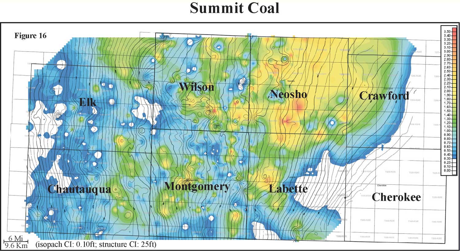
Isopach mapping of the Summit coal reveals a coal that is laterally discontinuous coal and has a consistency in thickness over an average of 6 miles (9.6 km; Figure 16). Thickness of the Summit coal ranges from 0 to 2.8 feet with an average of 1 foot and a distribution that is slightly skewed to the minimum (0 to 0.9 m, average if 0.3 m). The Summit coal exhibits an irregular circular to polygonal geometry. Structure appears to have a weak influence on coal thickness. When overlying contours of top Blackjack Creek Limestone structure onto an isopach of Summit coal thickness, the coal appears to thicken on some of the highs and thin into lows. The Summit coal is consistently thicker in Neosho County. Areas and trends of thin Summit coal thickness may be due to non-deposition or deposition of carbonaceous shale instead of coal.