| Kansas Geological Survey Open-File Report |
Index of Images || Small Web Image || Large Web Image || Acrobat PDF (16.5 Megs)
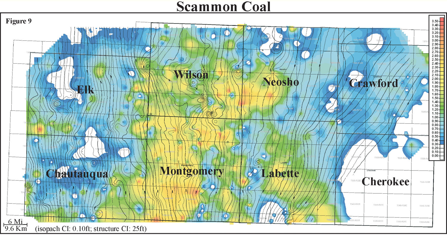
Thickness of the Scammon coal ranges from 0 to 3 feet with an average of 1 foot and distribution slightly skewed to the minimum (0 to 1 m, average of 0.3 m). Detailed isopach mapping of the Scammon coal reveals a coal that remains fairly constant in thickness over an average of 6 miles (9.6 km). When structural contours of top of the Skinner Sandstone are overlain onto an isopach of Scammon coal thickness, the coal appears to thicken on highs and thin into lows.
Highs associated with the Skinner Sandstone may be due to differential compaction, where thicker Skinner Sandstone units will provide a relatively higher topographic area. Local thin trends within thicker Scammon coal may be due to removal by fluvial erosion. The Scammon coal exhibits an irregular geometry that is oriented parallel and oblique to depositional dip, and is consistently thicker in Labette, Montgomery and Wilson counties.