| Kansas Geological Survey Open-File Report |
Index of Images || Small Web Image || Large Web Image || Acrobat PDF (18.7 Megs)
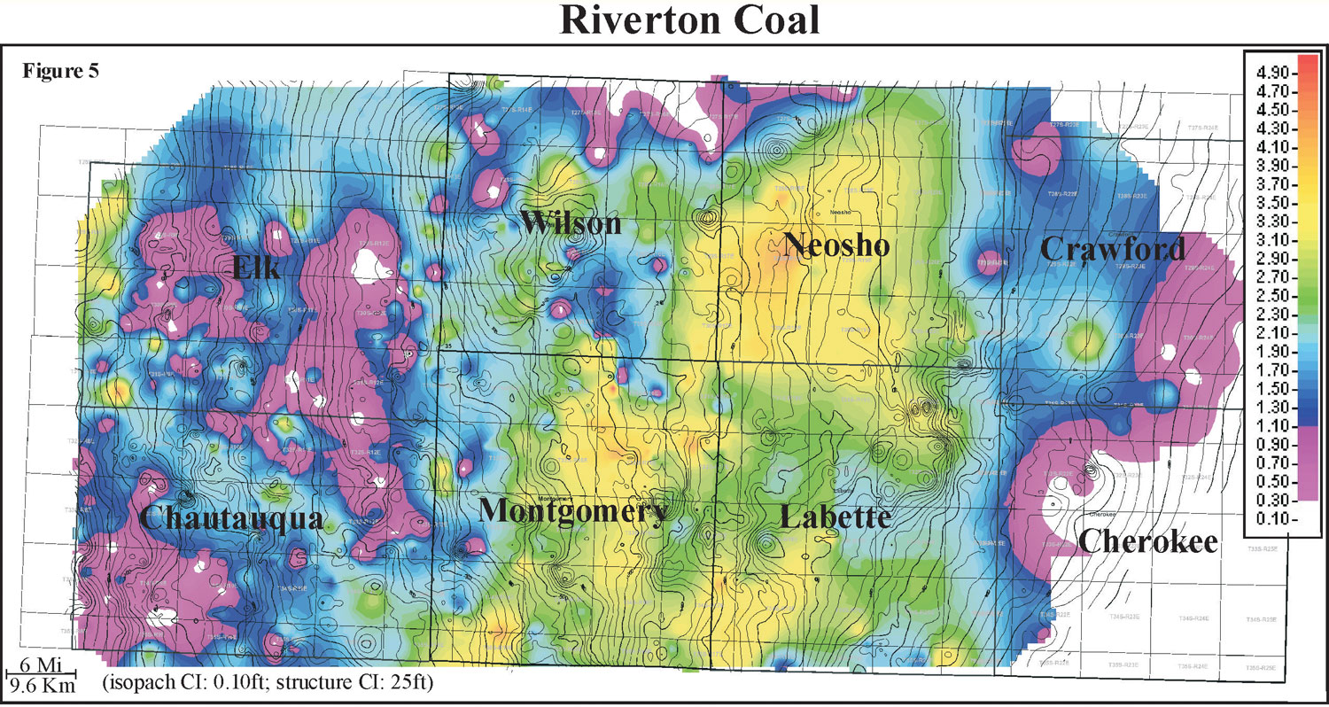
Isopach mapping of the Riverton coal reveals a coal that stays fairly consistent in thickness over an average distance of 5 miles (8 km). Thickness of the Riverton coal ranges from 0 to 4.5 feet with an average of 1.8 feet and a normal distribution (0 to 1.4 m, average of 0.5 m). The Riverton coal locally appears to thicken into the Mississippian lows and thin onto the highs. The Riverton coal exhibits a lenticular geometry that has an irregular distribution and is consistently thicker in Montgomery, Labette, and Neosho counties, while its thins to the west and east in the study area.