| Kansas Geological Survey Open-File Report |
Index of Images || Small Web Image || Large Web Image || Acrobat PDF (17.1 Megs)
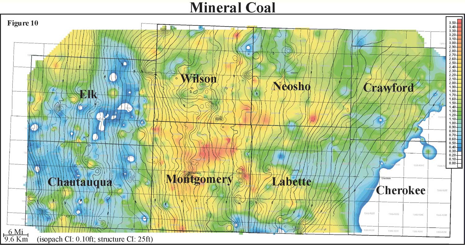
Thickness of the Mineral coal ranges from 0 to 4 feet with an average of 1.4 feet and normal in distribution (0 to 1 m, average of 0.4 m). Isopach mapping of the Mineral coal reveals a coal that stays fairly constant in thickness over an average distance of 6 miles (9.6 km). The Mineral is the next laterally extensive and thick coal above the Weir-Pittsburg coal. Consistent with many of the other Cherokee Group coals, the paleotopography reflected in structure appears to influence coal thickness. When structural contours of bottom of the Mineral coal are overlain onto an isopach of Mineral coal thickness, the coal appears to thicken on highs and thin into lows. The Mineral coal exhibits a lenticular geometry that is oriented parallel to depositional strike, and is consistently thicker in Labette, Neosho, Montgomery, Wilson, and Cherokee counties. Localized thin areas in the Mineral coal are usually circular in map view, and may be due to removal by fire or crevasse splays.