

Prev Page--Figure 9.1 ||
Next Page--Figure 9.8
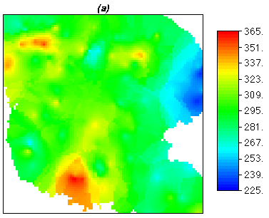
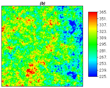
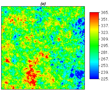
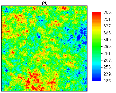
Figure 9.5. Dakota formation thickness (in feet), south-central Hodgeman county,
Kansas. For reference [map (a)] is a copy of
Figure 9.1 and the other maps are realizations by sequential
Gaussian simulation.
Kansas Geological Survey, Mathematical Geology Section
Updated March 1999
URL="http://www.kgs.ku.edu/Mathgeo/Books/Geostat/fig9_5.html"