

Prev Page--Figure 12.5 ||
Next Page--Figure 14.5
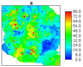
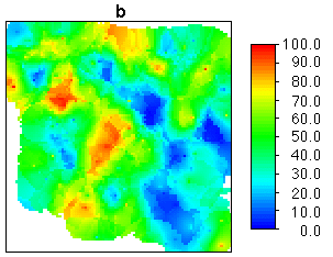
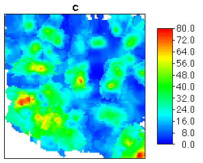
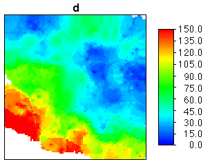
Figure 14.3 Cumulative thickness maps (in feet) for units comprising the Dakota
aquifer, south-central Hodgeman County, Kansas.
Map (a): upper "J"
Map (b): lower "J"
Map (c): Kiowa
Map (d): Cheyenne
Kansas Geological Survey, Mathematical Geology Section
Updated March 1999
URL="http://www.kgs.ku.edu/Mathgeo/Books/Geostat/fig14_3.html"