1999 Annual Water Level Raw Data Report for Kansas
Prev Page--Executive Summary || Next Page--Statistical Quality Control
Richard D. Miller, Exploration Services Section
Acquisition Logistics
The primary measurement trip was completed in 5.5 days by a crew of six people (with a seventh for the first four days). Each person was equipped with a vehicle, computer, GPS, cellular phone, field notes, steel measuring tape, and associated supplies. The far north-western counties (Cheyenne, Sherman, and Wallace) were completed the first day, requiring an overnight stay in Syracuse. The second day of measurements ended in Garden City and saw the completion of two counties (Hamilton and Kearny). The third field day ended in Liberal with three counties finished (Finney, Haskel, and Grant). The fourth day ended in Dodge City, with three more counties (Stevens, Seward, and Meade) completed. The crew next stayed over-night in Great Bend after completing three more counties on the fifth day (Gray, Ford, and Hodgeman). The sixth day was the last day of the primary trip and required only a half-day for four people to complete the last three counties (Ness, Pawnee, and Barton).
During the primary acquisition trip the six crew members were divided into three teams. Each team was responsible for 26 to 34 wells per day along predesignated closed routes. Each day's route was designed so team members would meet along the route after all the wells were visited. This method balanced workloads by compensating for different degrees of measurement difficulty (different lengths of time are necessary to measure individual wells), insured that no wells were overlooked during the primary measurement trip, and minimized the number of miles traveled per well and route. Distribution of crew members and routes was designed to insure that no crew member was more than 15 to 20 miles from another crew member. This increased safety and minimized the time necessary to complete a county. Once a team completed its route, the other teams were contacted to determine if assistance was necessary to complete all routes prior to sunset. After a team completed its route and fulfilled any requests for assistance, they proceeded to a predesignated motel. Approximately 11,500 miles were logged during the primary measurement trip with the average crew member visiting 15.9 wells per day and spending about 13 minutes at each well and about 23 minutes traveling from well to well.
QC/MIA/QA/Enhancement Wells
The QC/MIA/QA/enhancement well trip required three days for two people to complete. The QC trip was designed to remeasure wells classified as out of trend during the primary trip. The QC water level remeasurement covered 11 counties and included 13 wells. These 13 wells were selected based on the following criteria:
The QA trip provided repeat measurement data for the purpose of statistical appraisal of measurement error. Fifty-two wells, or about 9% of all the wells measured by the KGS during 1999, were randomly selected by computer for remeasurement.
Again this year, an attempt was made to fill some of the spatially undersampled areas within the network (Olea, 1998). To fully sample the High Plains Aquifer from water level data, 37 new well sites were needed. Input from the GMDs, DWR, and KGS identified 34 wells in areas that are spatially undersampled and that have sufficient historical and construction data to justify an attempted measurement. From those 34 candidate wells, 14 were sampled during 1999 as new annual network wells. The selection and measurement of these enhancement wells is critical to establishing a method for maintaining the health and continuity of the network through the insertion of new wells to replace unusable wells already in the network.
Well and Measurement Point Information
A few key well characteristics have been compiled for general information and incorporation into efforts to improve and maximize the network. Included when possible are statistics and characteristics for DWR wells as well.
| Wells Measured in 1999 | ||
|---|---|---|
| Type of Well | KGS | DWR |
| Irrigation | 419 | 547 |
| Unused (monitor or abandoned) | 103 | 163 |
| Stock | 19 | 29 |
| Household | 8 | 20 |
| Depth to Water | KGS | DWR |
| Less than 100 ft | 209 | 447 |
| 100 to 200 ft | 237 | 280 |
| 200 to 300 ft | 94 | 48 |
| More than 300 ft | 16 | 3 |
| Drill Depth of Well | KGS | DWR |
| Unknown | 14 | 77 |
| Less than 100 ft | 98 | 236 |
| 100 to 200 ft | 99 | 272 |
| 200 to 300 ft | 151 | 135 |
| 300 to 400 ft | 104 | 33 |
| More than 400 ft | 90 | 25 |
| Measurement Characteristics | KGS | DWR |
| Oil on the water | 93 (17%) | 99 (13%) |
| Difficult measurement (restrictions, snags, catches) | 205 (36%) | 31 (3%) |
| Noted changes in restrictions | 42 (8%) | 17 (2%) |
In-field confidence in a particular measurement was qualitatively determined through inspection of chalk cut while general accuracy was quantitatively appraised using historical and local trends.
| Measurement Confidence | ||
|---|---|---|
| Wells Measured Only | KGS | DWR |
| Once | 425 | 767 |
| Twice | 100 | 11 |
| Three times | 20 | 0 |
| Four times | 11 | 0 |
| Total Measurements | KGS | DWR |
| During primary and QC trips | 743 | 823 |
| During QA trips | 65 | N/A |
| Measurements Judged | KGS | DWR |
| Excellent | 450 | 730 |
| Good | 91 | 40 |
| Fair | 15 | 18 |
Network Continuity
An uninterrupted historical record is important for trend determination and analysis. Significant efforts were made to acquire measurements in all wells regardless of whether the well had been successfully measured in any of the last three years. Wells with problems that were not likely to improve between measurement years were identified by each measurer and then cross-checked by the QC measure. If both visitors indicate a well needs to be removed from the network, it generally is dropped from the next year's list of annual measurement wells.
| 15 Wells from KGS Portion Requiring Replacement and Reason | |
|---|---|
| 03S 42W 26CCD 01 | Obstruction at ~185 ft. ('97, '98, '99) |
| 21S 18W 32DAA 01 | Buried under packed gravel at Co-op. ('98, '99) |
| 21S 22W 12BCB 01 | Solid obstruction at MP. ('98, '99) |
| 23S 39W 15ADD 01 | Abandoned windmill blockage at last year's DTW. ('99) |
| 24S 26W 35CBC 01 | Encountered obstruction at 56 ft. ('99) |
| 25S 33W 17DBD 01 | Obstruction could not get past. ('99) |
| 25S 33W 33CDA 01 | Cannot get past 180'. ('99) |
| 27S 32W 03CBB 01 | Can't get past 180-190' spotty cut, not reliable measure. ('98, '99) |
| 27S 38W 23CBB 01 | Well plugged. Ice in borehole. Cement grout at 2' BGS. ('99) |
| 30S 34W 02BAD 01 | Difficult to measure, bad hang at 350' rusty tape no water ('99) |
| 30S 34W 30 ADD 02 | Tape goes dead at 135'. Comes up rusty. Seems dry. ('99) |
| 31S 39W 23BBB 01 | Can't get past 185'. Lost tension between 180 and 190. ('99) |
| 32S 38W 11ADA 01 | Not found. ('98, '99) |
| 33S 31W 28DDB 01 | Pump placed over (U) well 1998--no access to water. ('99) |
| 33S 38W 20DDB 01 | Reported plugged summer 1998. ('99) |
| 22 Wells from DWR Portion Requiring Replacement and Reason | |
|---|---|
| 02S 35W 34CAA 01 | Bad casing. |
| 04S 35W 06DCD 01 | Unable to measure for three years, now submersible. |
| 06S 21W 19CDC 01 | Well destroyed. |
| 07S 33W 35ADD 01 | No valid measurement since 1993. |
| 08S 29W 01DCB 01 | Well moved/replaced. |
| 11S 28W 17DCB 01 | Submersible pump. |
| 15S 40W 26CAB 01 | Unable to measure for three years. |
| 15S 18W 25CCD 01 | Plugged. |
| 16S 38W 10ABB 01 | Unable to measure, replaced. |
| 23S 01W 19AAC 01 | Casing collapsed. |
| 24S 08W 04AB 01 | Well destroyed. |
| 24S 18W 36DDC 01 | No MP. |
| 25S 02W 16DDB 01 | Unable to measure for three years. |
| 26S 01W 31CCD 01 | Well plugged. |
| 27S 40W 16CCC 01 | Metal plate covers MP. |
| 27S 07W 03ADC 01 | Plugged. |
| 28S 19W 30CBC 01 | Sealed with cement. |
| 28S 40W 32CCB 01 | Unable to measure for three years. |
| 29S 15W 02CCA 01 | Unable to measure for three years. |
| 29S 37W 08CBA 01 | Unable to measure for three years, buried under 4 ft of dirt. |
| 33S 43W 08BDA 01 | Unable to measure for three years. |
| 34S 43W 07BDD 01 | Unable to measure for three years, no MP access. |
To maintain the long-term health and continuity of the network, both wells that should be replaced and acceptable replacements should be immediately identified. Field observations are the most important and insightful method of identifying wells needing replacement; however, statistical quality control analysis has provided valuable insight into the reliability of network wells measured in 1999. A group of 24 wells have measurements that appear erratic when compared to measurements in 1998. When these 24 wells are removed from the 1999 data set, all variation except aquifer code and use of weighted tape is eliminated. All of these wells have at least two measurements and many have four or more. Repeated measurements suggest that these wells are very difficult to measure with confidence. Replacement of these wells is highly recommended. The statistical analysis turned up this relatively small number of wells that could have a major negative influence on analyses done using these data.
| 24 Wells from KGS Portion with Erratic Behavior in 1999 | ||
|---|---|---|
| 04S 39W 15CCA 01 | 23S 34W 21DDC 01 | 26S 41W 32DDB 01 |
| 06S 38W 09ABD 01 | 23S 35W 25BBB 03 | 27S 23W 28AAA 01 |
| 06S 38W 18DBD 01 | 24S 23W 06AAB 01 | 29S 34W 11ADD 01 |
| 21S 39W 07CBA 01 | 24S 33W 18BDB 02 | 30S 26W 32DDD 01 |
| 23S 22W 07DAA 01 | 24S 33W 19DBB 02 | 31S 26W 30BBB 01 |
| 23S 33W 26ABB 01 | 24S 43W 14CBB 01 | 31S 28W 10BCB 01 |
| 23S 33W 28CDC 01 | 25S 23W 11CCC 01 | 32S 36W 21AAC 01 |
| 23S 34W 17CCC 01 | 25S 34W 34DBD 01 | 33S 35W 23CBB 01 |
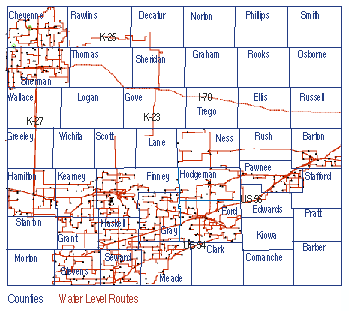
For a second year the KGS crews were deployed with acquisition software running on notebook PCs interfaced to GPS units. This system has been under development at the KGS for the last three years. It is designed to provide the measurer with historical data, warning messages in the event of an out-of-trend measurement or incorrect well location, automated depth-to-water calculations based on hold and cut, and real-time tracking and vehicle location displays. The system's primary focus is on insuring that the correct wells are measured and on enforcing com-plete well site documentation. The GPS units provide the associated computer with a tracking log, which permits time and location of each measurer to be determined throughout the day. During the 1999 measurement program the KGS crews logged over 11,000 miles in 6 days (Figure 3). GPS-measured latitudes and longitudes can be extracted from this log and used to improve the accuracy of well locations in WIZARD.
Figure 3--Tracking logs of all measurers during the first six days of the 1999
measurement program as recorded by the GPS/computer systems located in each
vehicle (not to scale).
The raw data tabulated in this report are organized into five appendices. A brief discussion of the contents of each appendix follows.
| Appendix A | Contains a summary of information for all wells measured by KGS. This appendix includes only county, well legal description (ID), and 1999 depth of water below ground surface (BGS). QA measurements (QA) are identified. |
| Appendix B | The same information as Appendix A, but for DWR wells. |
| Appendix C | Contains all measurements and characteristics taken at every well in the KGS portion of the network. Included are the following categories of informa-tion: County, legal description (ID), GPS Lat, GPS Long, hold point, cut line, measurement point (MP) elevation, 1999 depth to water BGS, initials of measurer, measuring agency, and all comments. |
| Appendix D | The same information as Appendix C, but for DWR wells. |
| Appendix E | List by county of wells (legal description, ID) measured as part of the QA program. The list includes the primary measurement of DTW and the QA measurement of DTW. |
| Appendix F | Contains the same information as Appendices C and D for the enhancement wells. |
A direct comparison of primary measurements and the QA measurements made by the KGS reveals important information about the accuracy and repeatability of information in the database (Appendix E). In general, the time separation between the primary and QA measurements is about a week to 10 days. This remeasure information, along with parts of the primary data, are integral to quality control discussions documented in subsequent sections of this report.
KGS Data Acquisition Summary
In summary, this year's effort by the KGS staff to acquire annual water level measurements met or exceeded most expectations. Based on preliminary analysis:
1) Systematic errors are an important indicator of erratic wells that should be removed from the network to insure that the network is accurate and that confidence can be placed in the data (see Statistical Quality Control Measurements section of this report).
2) More data have been acquired in each of the last three years (1997-1999) than in the previous 7 years (1990-1996).
4) Field acquisition time has been reduced (1999 required 5.5 days; 1998 required 6.5 days; 1997 required 8 days; the historical average of time required for field data collection has been about 2 months).
5) Long-term improvements to the network and database are being made.
g) The Quality Control program is providing valuable information about measurable wells that have erratic behavior and which should be removed from the network.
6) The total program costs for 1999 were about 75% of 1998 and 1997, which were both consistent with the amount paid to the USGS in 1996 to complete this study. When calculated using an equivalent* product, the cost to the Kansas Survey for the 1997 and 1998 water level data is about half that assessed by the USGS in 1996 and less than one-third of the USGS 1996 costs for the 1999 acquisition season. (*Equivalent product cost does not include extra program activities such as QA or QC data acquisition, analysis, or computer and GPS equipment.)
Development of a Kansas water well database was undertaken by the KGS in an attempt to make information quickly and easily accessible to the general public about water wells, both those that are part of the annual network and many that are not. This data-base will hopefully provide quick and accurate information about potential replacement or enhancement candidates throughout the State. At the present time this database is still under development, but should be fully operational by next field season. The database, by design, will include all significant information contained in the USGS's GWSI database, the KGS's KIWI database, and the KGS's WaterWitch database. It is the intent of the database's designers to incorporate portions of DWR's WRIS, KDHE's WWC5, City of Wichita, and each of the five GMDs' water well databases. Once this database, named WIZARD, is complete it should contain the most inclusive listing anywhere of information on water wells in Kansas. It is the intent that frequent uploads from each of the parent databases will insure that information in the database is current.
References
Miller, R.D., 1996, The acquisition of annual water levels in Kansas sponsored through a cooperative agreement between the KGS and USGS: Kansas Geological Survey Open-file Report 96-39.
Miller, R.D., J. Davis, and R.A. Olea, 1997, Acquisition activity, statistical quality control, and spatial quality control for 1997 annual water level data acquired by the Kansas Geological Survey: Kansas Geological Survey Open-file Report 97-33.
Miller, R.D., J. Davis, and R.A. Olea, 1998, 1998 annual water level raw data report for Kansas: Kansas Geological Survey Open-file Report 98-7.
Olea, R.A., 1997, Sampling analysis of the annual observation water wells in Kansas: Kansas Geological Survey Open-file Report 97-73, 44 p, 10 plates.
Prev Page--Executive Summary || Next Page--Statistical Quality Control