


Acquisition Activity, Statistical Quality Control, and Spatial
Quality Control for 1997 Annual Water Level Data Acquired by the Kansas
Geological Survey
Back to Spatial Analysis
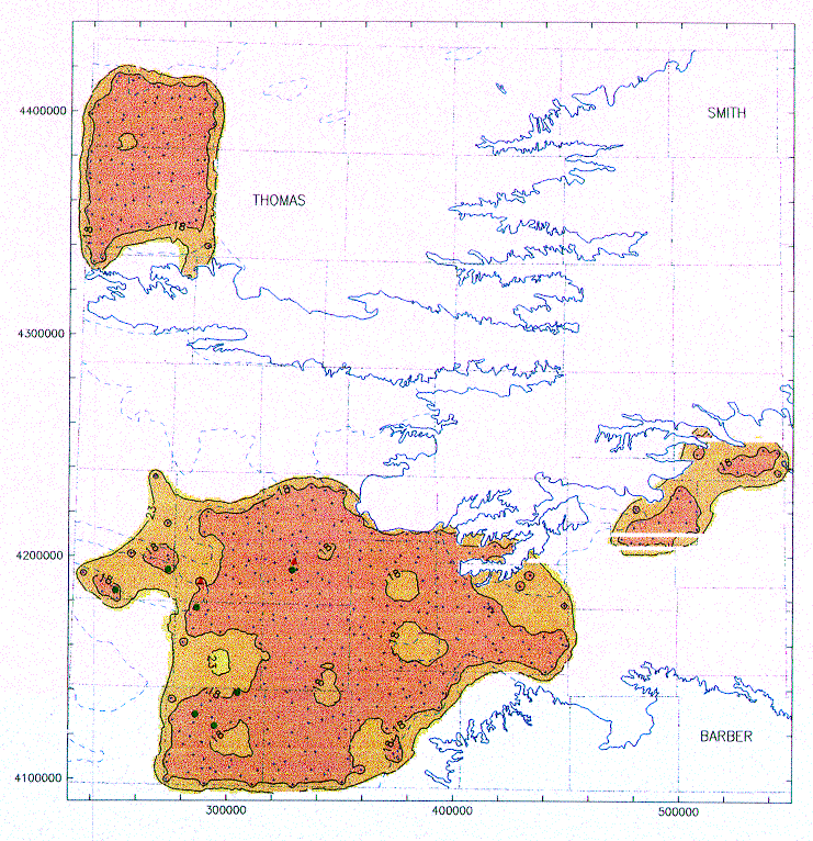
Figure 9--Universal kriging standard deviation for the
edited sampling. A cross
denotes a well with a z-score below 3; a red dot, between 3 and 4; and a red
triangle, larger than 4. The solid blue line is the actual boundary of the High
Plains aquifer and the segmented line the boundary of its non-
contributing portion.
Back to Spatial Analysis
Kansas Geological Survey, Water Level CD-ROM
Send comments and/or suggestions to webadmin@kgs.ku.edu
Updated Feb. 25, 1997
Available online at URL = http://www.kgs.ku.edu/Magellan/WaterLevels/CD/Reports/OFR9733/ofig9.htm