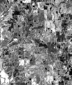
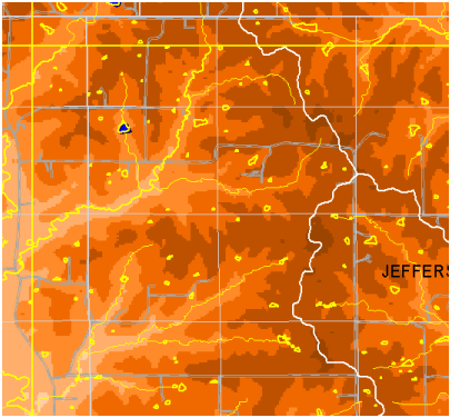
ASTER near-infrared (below) and false color (right) compared to GIS-based map of the same area in SE Jefferson Co., Kansas. Map shows roads, elevation, and surface water features (yellow lines and polygons) form the 1:24,000 Kansas Hydrography coverage. This is based on ~1991 aerial photographs digitized by the NRCS; ASTER coverages are from 1992.
At the reduced image size the pond correspondence appears good, but examination of the expanded near-IR image (bottome of page) shows a large number of 1-4 pixel dark features that are water body candidates and do not appear on the Hydrography coverage. ASTER resolution is 15 m; one-meter aerial photography will resolve and permit identificaiton of the suspect additional features.