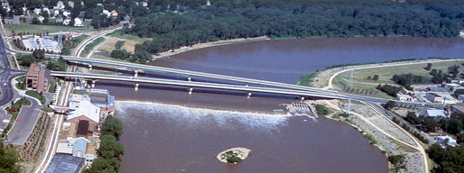
Kansas River Index Well Network
In the spring and summer of 2018, the KGS established a network of observations wells in the Kansas River alluvial aquifer. The wells operate under the Kansas Index Well Program to provide continuously recorded water levels of the aquifer throughout the year. Funding for the project was made possible by the Kansas Water Plan Fund and the USGS National Groundwater Monitoring Network.
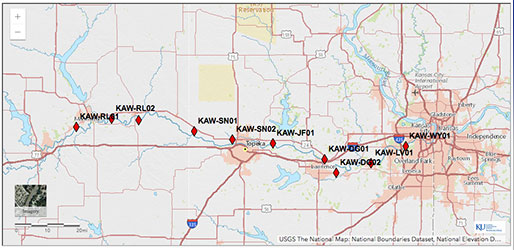
Interactive Map
Use our interactive map to explore the data received, or use the data links below.
Data
- RL01, Riley County southwest of Manhattan
- Wizard well page
- Continuous Measurements
- RL02, Riley County near St. George
- Wizard well page
- Continuous Measurements
- PT01, Pottawatomie County east of Wamego
- Wizard well page
- Continuous Measurements
- PT02, Pottawatomie County northeast of Wamego
- Wizard well page
- Continuous Measurements
- WB01, Wabaunsee County southeast of Wamego
- Wizard well page
- Continuous Measurements
- WB02, Wabaunsee County, south of St Marys
- Wizard well page
- Continuous Measurements
- SN01, Shawnee County near Rossville
- Wizard well page
- Continuous Measurements
- SN02, Shawnee County north of Topeka
- Wizard well page
- Continuous Measurements
- JF01, Jefferson County southeast of Grantville
- Wizard well page
- Continuous Measurements
- JF02, Jefferson County, south of Perry
- Wizard well page
- Continuous Measurements
- DG03, Douglas County, northeast of Lawrence
- Wizard well page
- Continuous Measurements
- DG01, Douglas County near Lawrence Municipal Airport
- Wizard well page
- Continuous Measurements
- GEMS4-1, Douglas County
- Wizard well page
- Continuous Measurements
- DG02, Douglas County between Lawrence and Eudora
- Wizard well page
- Continuous Measurements
- LV01, Leavenworth County north of De Soto
- Wizard well page
- Continuous Measurements
- WY01, Wyandotte County north of Lake Quivira
- Wizard well page
- Continuous Measurements
Reports
- Open-file Rept. 2022-6
- Kansas River Alluvial Aquifer Index Well Program: June 2020 to May 2022 Report, by J. J. Butler, Jr., E. C. Reboulet, S. Knobbe, G. C. Bohling, D. O. Whittemore, J. Voss, and B. B. Wilson
- Open-file Rept. 2020-14
- Kansas River Alluvial Aquifer Index Well Program: 2019 Annual Report, by J. J. Butler, Jr., E. C. Reboulet, S. Knobbe, D. O. Whittemore, B. B. Wilson, and G. C. Bohling
- Open-file Rept. 2019-17
- Maintenance of the Kansas Geological Survey's Data Services to the National Groundwater Monitoring Network and Establishment of a Trend Well Network in the Kansas River Alluvial Aquifer, by Brownie Wilson
- Open-file Rept. 2019-18
- Kansas River Alluvial Aquifer: Water Use and Real-Time Monitoring, Guide for Field Trip, March 27, 2019, Geological Society of America, 2019 Joint Section Meeting, Manhattan, Kansas, by Donald O. Whittemore, Brownie Wilson, and James J. Butler, Jr.