


|
|
|
|
| Solution mining has resulted in land subsidence in and around the city of Hutchinson. | |
| Relation of roof rock failure to method of salt mining (after Walters, 1978) | ||
|---|---|---|
| Mining Method | Portion of Salt Removed | Associated Surface Subsidence |
| Underground Mines | One bed 8' to 15' thick in lower salt; room and pillar with 75% of salt removed. |
None known |
| Solution Mining 1888-1960s |
Predominantly the uppermost salt decreasing downward. | Known surface subsidences in 1914, 1925, 1952, 1974 |
| Solution Mining 1960s-1970s |
Predominantly the lowermost salt decreasing upward. Void space is a narrow corridor. |
None known |
| Solution Mining for storage of Liquefied Petroleum Gas |
Lower salt below "shale" marker; 100' +/- vertically, 40' +/- diameter. |
None known |
| Hutchinson, Kansas: Land Subsidence Areas (after Walters, 1978) | |||
|---|---|---|---|
| Year | Company | Area | Remarks |
| 1914 | Morton Salt Company | Southwest of city | Rapid surface cratering |
| 1925 | Carey Salt Company | Downtown | Slow subsidence of only a few inches |
| 1952 | Barton Salt Company | Southeast of city, north of plant | Ground subsidence with water coming in the hole |
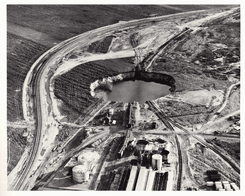
| 1974 | Cargill (formerly Barton) | Southeast of city, south of plant | 300 ft diameter crater, volume calculated to be 90,000 cubic yards (see photos below) |
Photographs of Cargill Sinkhole-1974 (from Walters, 1978)
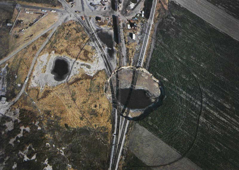
Cargill Sinkhole, October 21, 1974
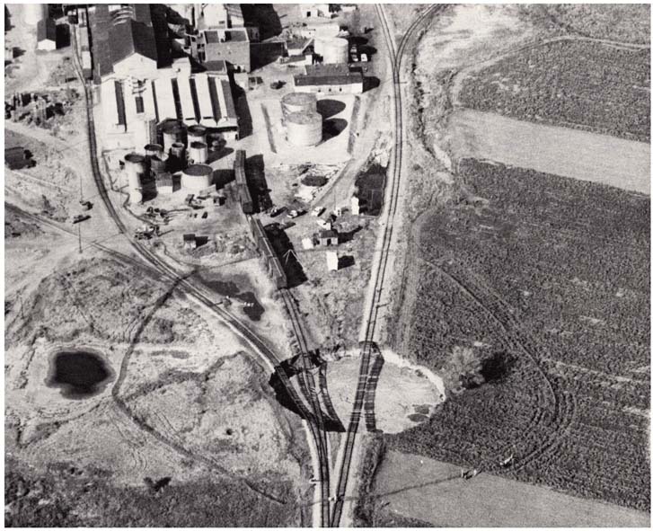
Cargill Sinkhole Stabilized, November 12, 1974
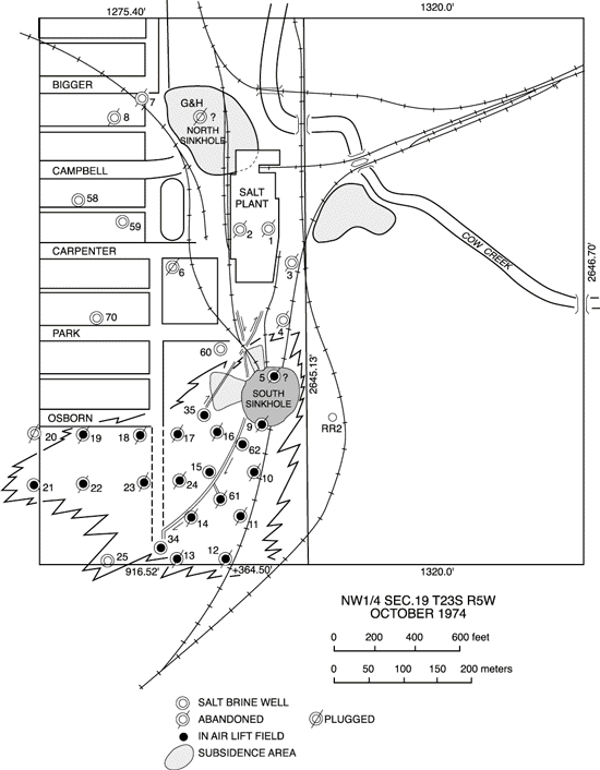
Cargill Plant Layout, Showing North and South Sinkholes and other Features (after Walters, 1978)
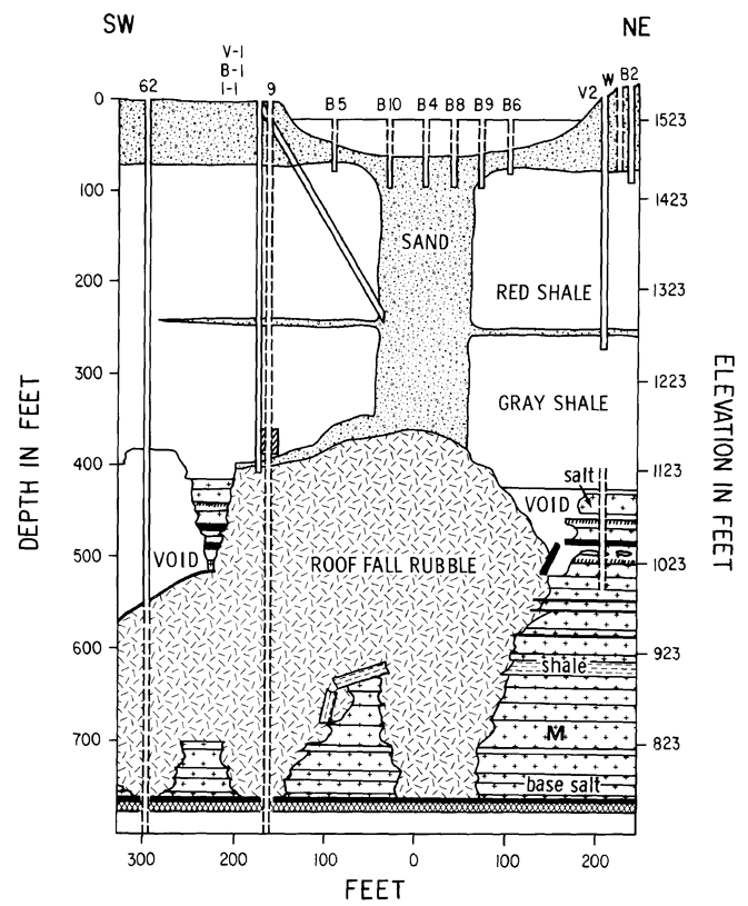
Cross Section Through South Sinkhole, Cargill Site (from Walters, 1978)

|
Info from the U.S. Geological Survey--Land Subsidence related to Groundwater Withdrawal: |
Prev Topic--Salt Mining || Next Topic--Gas Storage