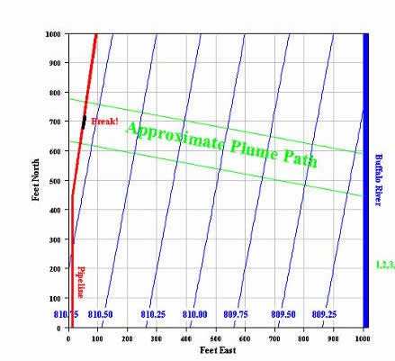
Map View is a user interface that allows you to interact with a mathematical model of the ground-water flow system. The interface displays a map of the spill site showing the pipeline, the location of the break (spill site), the Buffalo River, and the approximate ground-water flow path from the pipeline break to the river. A grid has been superimposed on the map to assist you in visually estimating distances between displayed features and the monitoring wells you will install as you hunt for the plume of contamination from the pipeline break.