|
Click on Townships to see detailed maps. (At township level, you can pan right/left and up/down by placing the mouse along the edges of the map). 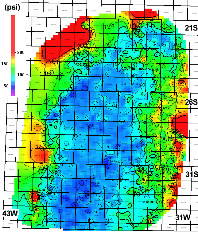
This page maintained by the Kansas Geological Survey. Updated June 1999 Comments to webadmin@kgs.ku.edu URL=http://www.kgs.ku.edu/Hugoton/hgamap.html |