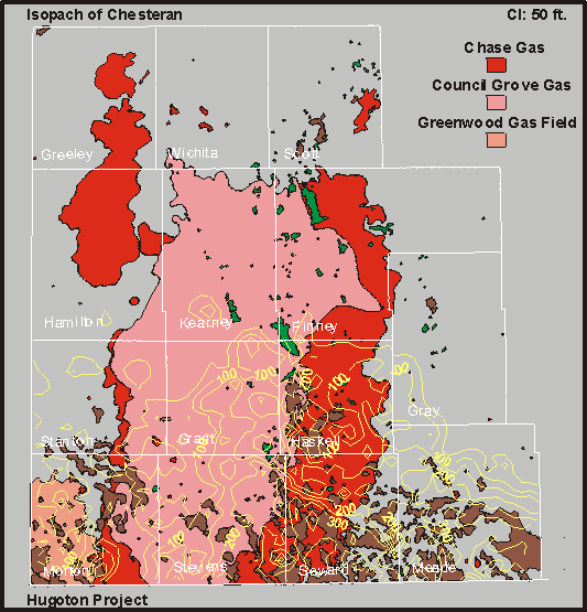
Isopach Map
Chesteran
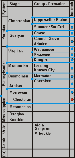
| Move Up--Morrowan | || | Bottom of Available Section |
|
|
|
Entire Hugoton Embayment Isopach Map Chesteran |
|
View Structure | |||
| Click on the blue circles or on unit names near circles on the strat column to move from map to map, or use the "Move Up" and "Move Down" links. Or click the map for County pages (place pointer on the county you want. Not all counties are online. | |||||||
|
|||||||