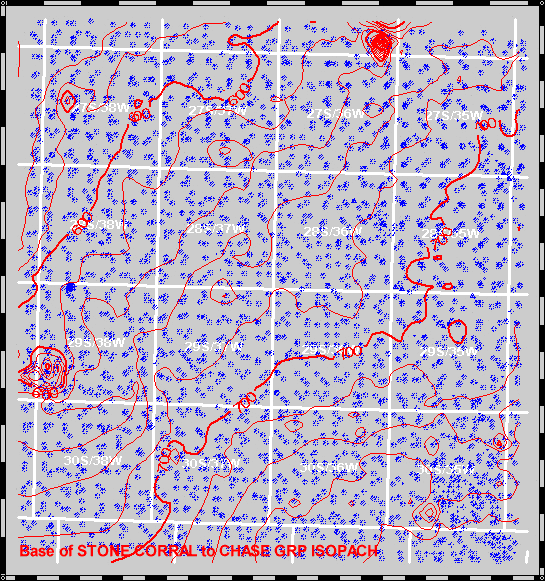
Isopach Map
Stone Corral/Chase
to move from map to map, or use the "Move Up" and "Move Down" buttons.
| Move Up--Nippewalla-Blaine to Stone Corral | || | Move Down--Chase to Council Grove |
|
|
|
Grant County Isopach Map Stone Corral/Chase |
View Structure | ||||
|
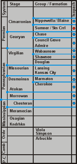
Click on the blue circles or on unit names near circles on the
strat column to move from map to map, or use the "Move Up" and "Move Down" buttons. |
|||||||
|
|||||||