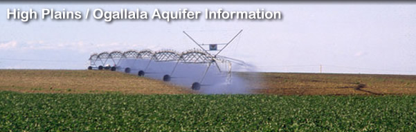
WRAPS and CREP Education
The Kansas Geological Survey (KGS) is assisting Kansas State University (KSU) in their activities for Upper Arkansas Basin WRAPS (Watershed Restoration and Protection Strategy) development, including education for the proposed Conservation Reserve Enhancement Program (CREP). Information on KSU WRAPS activities is available on the web page http://www.kcare.ksu.edu/DesktopDefault.aspx?tabid=859 of the Kansas Center for Agricultural Resources and the Environment (KCARE). The Kansas Department of Health and Environment is coordinating WRAPS activities in Kansas (www.kdheks.gov/nps/wraps/index.htm). The proposed Kansas CREP is being developed by the Kansas Water Office (KWO) in cooperation with other state, local, and federal agencies, the Kansas Water Authority, and stakeholders. Information on the proposed Upper Arkansas basin CREP is available on the KWO web page.
 |
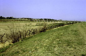 |
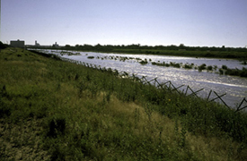
Above: Arkansas River during high flow of 1995 (left) and the dry channel as it usually appears now.
KSU organized three educational meetings on CREP and WRAPS in early December, 2006 that were held at fairgrounds buildings in Garden City, Dodge City, and Larned. K-State Research and Extension and Kansas Conservation Districts sponsored the meetings. The following presentations were given at each of these three meetings:
- Overview of the Proposed CREP – Tracy Streeter, Director, Kansas Water Office
- Economic Aspects of CREP Scenario Analysis – Troy Dumler, K-State Research and Extension
- Predicted Ground-Water Levels and River-Aquifer Interactions under Various Scenarios – Don Whittemore, Kansas Geological Survey
- Plans for Upper Arkansas Basin WRAPS – Bob Frisbie, K-State Research and Extension
There were two different versions of the KGS presentations, one for the upper Arkansas River corridor from the Colorado-Kansas border to the Ford-Edwards county line and one for the Middle Arkansas subbasin from the Ford-Edwards county line to Great Bend.
Upper Arkansas River corridor presentation at Garden City and Dodge City:
Ground-Water
Levels and River-Aquifer Interactions in the Upper Arkansas River
Corridor in Southwest Kansas
(Note: Two slides showing versions of an estimated usable lifetime
map for the High Plains aquifer in Kansas were added later to this
presentation in response to questions during the meetings. The
link to the animated PowerPoint slide that was in the presentation
that shows the ground-water level changes in western Kansas during
1996-2006 is HPA-WL-change-1996-2006. The animation should start
once the slide is brought into slide show view.
One-page (two sides) handout for presentation at Garden City and Dodge City: UARC handout
Middle Arkansas subbasin presentation at Larned:
Ground-Water Model and Pumping Scenarios for the Middle Arkansas Subbasin
One-page (two sides) handout for presentation at Larned: Mid Ark model handout
Presentation and handout for Kansas Legislature hearings on CREP bills of Senate and House:
Updated October 17, 2007
Comments to webadmin@kgs.ku.edu