Figure 1 shows Koeppens Climate Classification of
the World. It illustrates the three broad categories of climate found
in Mexico described by OBrien and Liverman (1996).
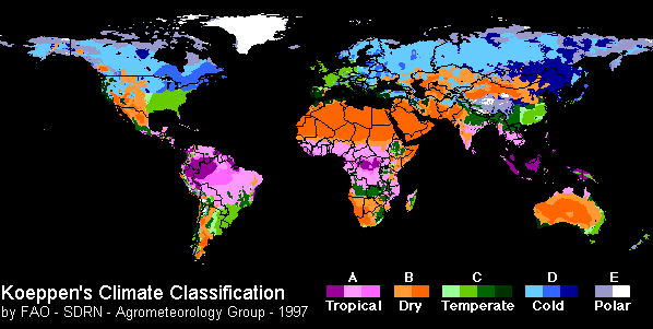
Mexico extends from 117`11W to 86`44W (~2700 km) and from 32`44N to 14`35N (~1800 km) and covers a geographic area of 1,972,550 square kilometers (ArcView GIS). Mexico shares a land border with the United States to the north and Guatemala and Belize to the southeast. However, Mexicos more extensive borders are with the Pacific Ocean to the south and west, the Gulf of Mexico to the east and part of the Caribbean Sea to the far southeast. The countrys extremely varied topography creates a diversity of climates (OBrien and Liverman 1996, p. 55):
The mountainous terrain and dissected topography of Mexico result in tremendous climate variability over short spatial distances, with variations corrresponding as much to altitude as to latitude. Other permanent controls influencing the climate include land-sea distributions, the influence of offshore ocean currents, and the location of tropical storm tracks. Despite large variations, the climate of Mexico can be divided into three broad categories:
1. The wet, tropical climates that are generally found in southern Mexico
and on the Pacific and Gulf coasts, south of latitude 24`N.
2. The temperate, seasonally moist climates typical of the mountainous
areas and central plains.
3. The dry climates generally found in the northern part of the country,
including the Baja California Peninsula and the Pacific coastal plains
north of latitude 25`N.
Figure 1 shows Koeppens Climate Classification of
the World. It illustrates the three broad categories of climate found
in Mexico described by OBrien and Liverman (1996).
Figure 1: Koeppens Climate Classification of the World illustrates
the three
broad climate categories found in Mexico.