
U.S. National Science Foundation Project OCE 00-03970
Click on a logo below to visit a project site.
![]()
![]()
![]()
GIS, database design and web interfacing by Jeremey Bartley and Grimay Misgna
GIS database development and web interfacing by Casey McLaughlin
Database administrative support: Kurt Look
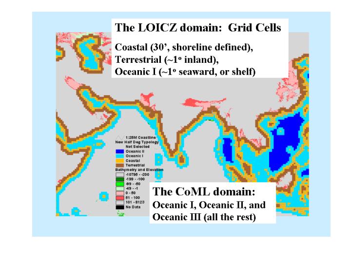
LOICZ Grid Cell System
Geographic conventions: NORTH latitude and EAST longitude are POSITIVE numbers; SOUTH latitude and WEST longitude are negative.
The objectives of the LOICZ cell structure
are to provide a geographically structured basis for database design that
will:
Half-degree
resolution has been selected as the most realistically useful compromise
between desired resolution and the available data and methods. Of the 259200
half-degree cells on the earth's surface, a total of 47057 have been identified
as primary typology cells (coastal, terrestrial and ocean-I). The remaining
oceanic cells (145989) are included to provide complete coverage for both
the larger LOICZ budget sites and for the NOPP/OBIS partner program, Biogeography
of the Hexacorallia. This cell structure also serves the needs of other
partner projects.
Land
or Terrestrial cells (T) are
typically defined as the cells containing only land (or fresh water). Coverage
typically extends 2 cells (one degree) inland from the most landward coastal
cell, although they have been extended farther inland in a few areas (e.g.,
estuaries not well represented by the shoreline data set). These will not
have ocean variables.
Coastal
cells (C), defined as those containing
a significant length of the World Vector Shoreline -- these cover significant
areas of both land and (marine or estuarine) water, and will be populated
with all classes of variables.
Oceanic
I cells (OI) are those extending
seaward from the coastal cells the greater of (a) one degree, or (b) the
50 or 100 m isobath in areas of a broad shelf, or (c) to include all of
a budgeted area. These will have only oceanic and atmospheric variables.
Oceanic
II cells (OII) are those additional
cells needed to complete the infilling of relatively enclosed water bodies
or coastal seas that might be the target of future up-scaled budgeting exercises.
Oceanic
III cells (OIII) cover all remaining
oceanic areas not included in the other classes.
Inland Cells (I) cover all remaining land areas not covered in other classes.
Cell ID numbers are based on a sequential global grid of half-degree cells. Numbering (from 1 to 259200) begins with the cell centered at 89.5 degrees N latitude and 179.5 degrees W latitude (89.5, -179.5) and proceeds from west to east. When a full circle (or row, in a planar projection) of 720 cells (360 degrees/0.5 degrees/cell) is completed, the numbering steps one cell south along the -180 meridian and continues sequentially west to east.
|
Cell Class |
Number of Cells |
|---|---|
|
Total primary Typology cells |
47057 |
|
Oceanic III |
143394 |
|
Oceanic II |
2595 |
|
Oceanic I |
19330 |
|
Coastal |
15278 |
|
Terrestrial |
12449 |
| Inland | 66317 |
|
Non-Typology Cells |
209517 |
|
Total number of 0.5 degree cells in the world |
259200 |
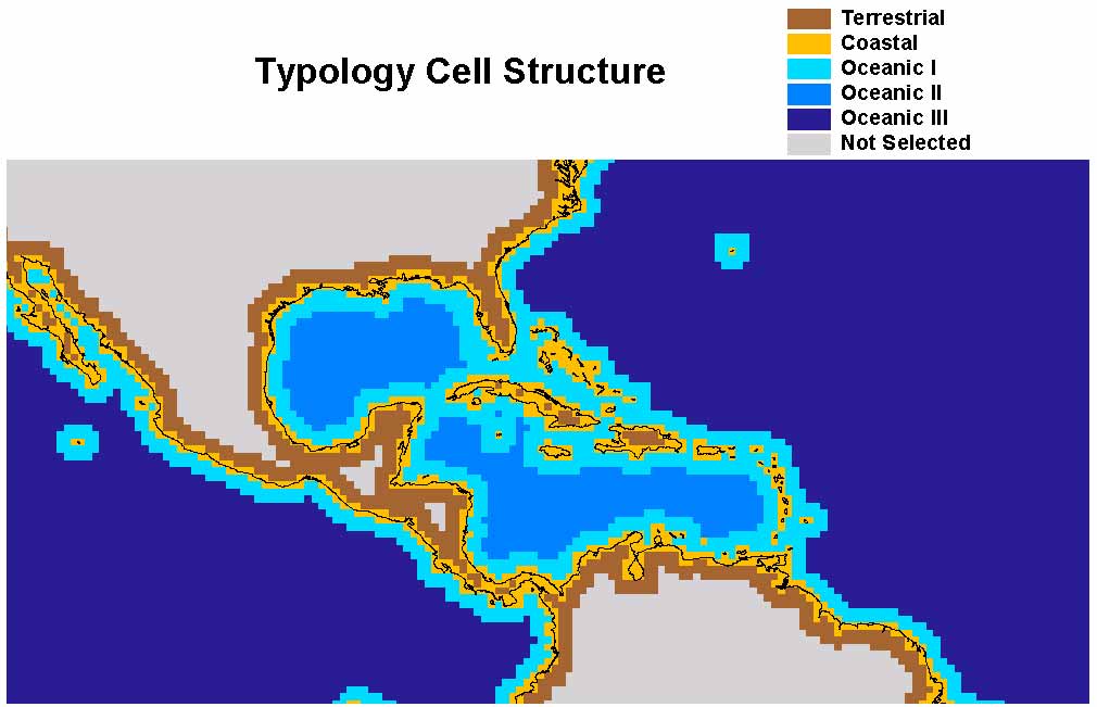
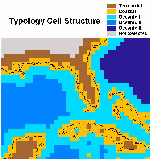
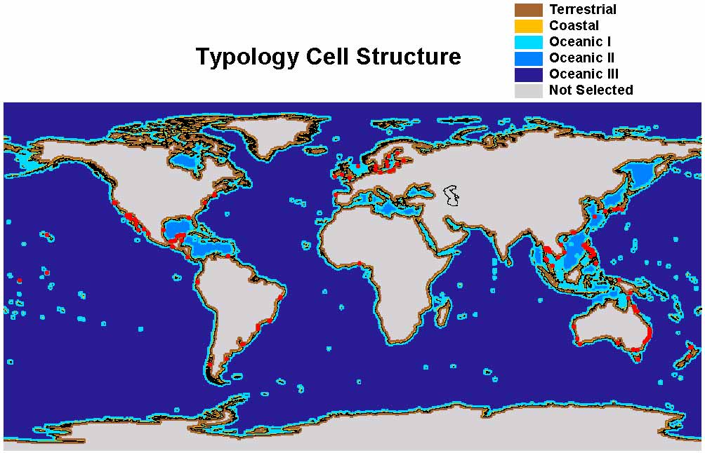
Typology cells: Illustrative views at various scales and with various features --
1. General (world) typology cell structure
2. Zoom to mid-Americas greater Caribbean general typology
3. Further zoom to to Florida/Gulf area
4. World typology with LOICZ budget sites (sites as of January 2001 -- inventory not current)
5. LOICZ and COML (Community of Marine Life)
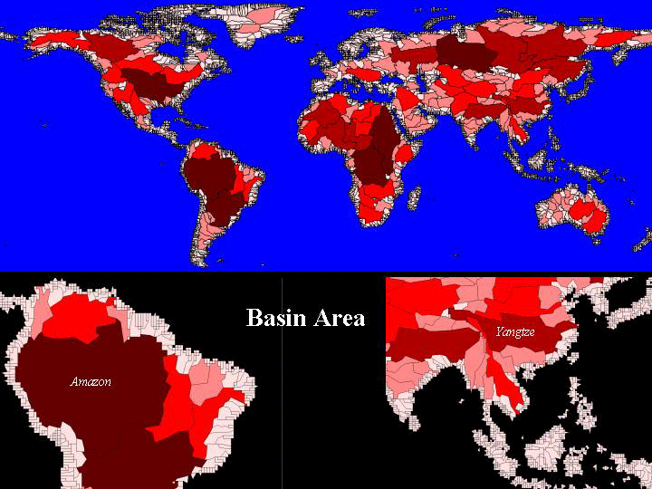
6. World Basins (Building block of the basins variables)
Older images of continents -- Terrestrial, coastal and ocean I cells only. Images are continuous on a single page; use links or scroll through.
![]()
![]()