Kansas Geological Survey, Maps M-41
by Xia, J., Miller, R.D., and Steeples, D.W., 1995: Kansas Geological Survey Map Series, M-41A.
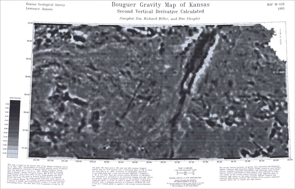
by Xia, J., Miller, R.D., and Steeples, D.W., 1995: Kansas Geological Survey Map Series, M-41B.
by Xia, J., Sprowl, D.R., Steeples, D.W., and Miller, R.D., 1995: Kansas Geological Survey Map Series, M-41C.
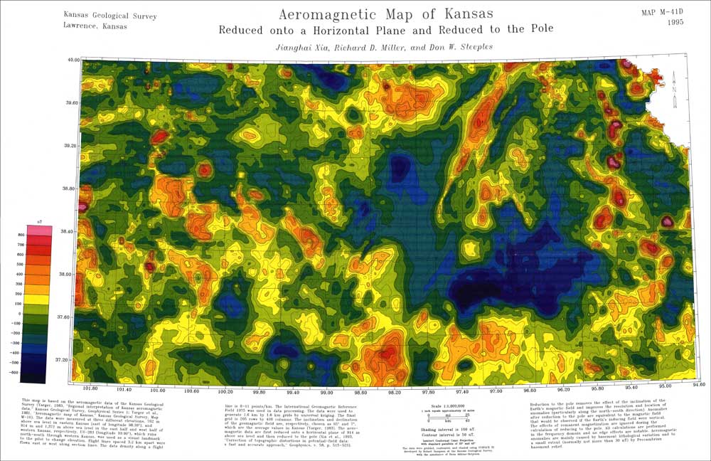
by Xia, J., Miller, R.D., and Steeples, D.W., 1995: Kansas Geological Survey Map Series, M-41D.
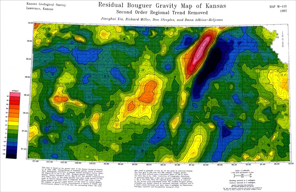
by Xia, J., Miller, R.D., Steeples, D.W., and Adkins-Heljeson, D., 1995: Kansas Geological Survey Map Series, M-41E.
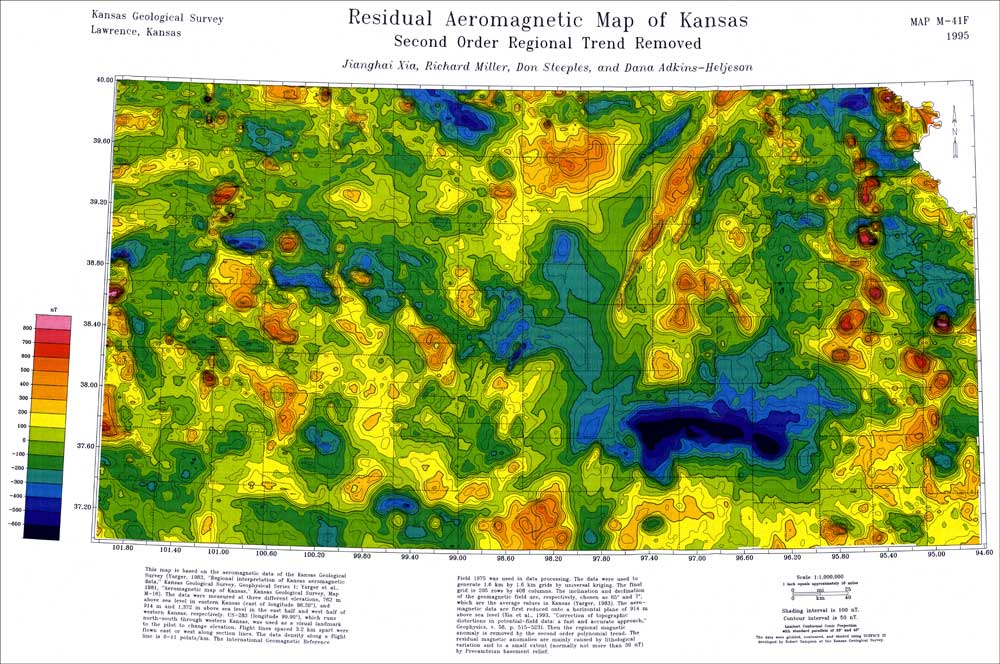
by Xia, J., Miller, R.D., Steeples, D.W., and Adkins-Heljeson, D., 1995: Kansas Geological Survey Map Series, M-41F.
Kansas Geological Survey, Geophysics
Placed online May 2005
Comments to webadmin@kgs.ku.edu
The URL for this page is http://www.kgs.ku.edu/Geophysics/Reports/M41/index.html