UTM coordinates (LatLngtoUTM)
UTM coordinates (LatLngtoUTM)
UTM coordinates (LatLngtoUTM)UTM (Universal Transverse Mercator) is a common projection used for most geographic information system (GIS) applications, land grids and commercial mapping. The LntLngtoUTM module in PfEFFER Pro converts longitude (x) and latitude (y) data to UTM x-y coordinates, in units of meters. UTM x-y coordinates can then be are mapped using orthogonal axes.
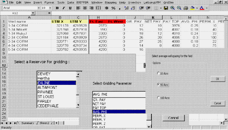
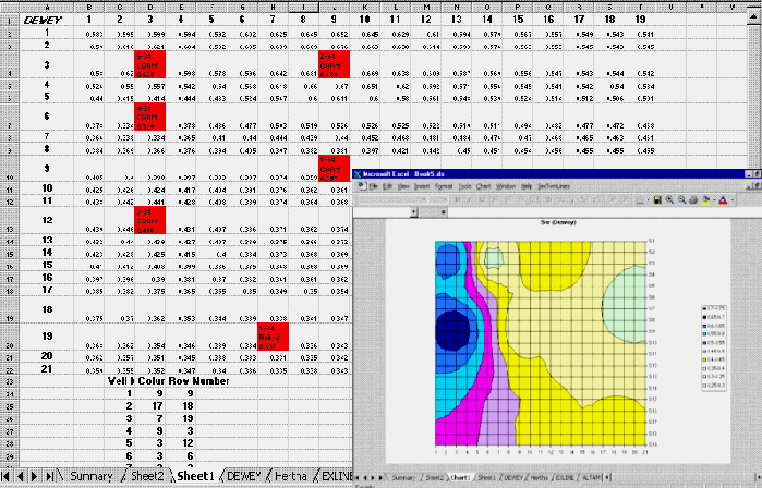
Generation of reservoir parameters for a fluid flow reservoir simulator (GridforSim)
This module was developed to link the elements of building
a petrophysical model and a simulation of the reservoir. Specific
goals include:
1. reduce complexity in building an input file for a simulation,
2. facilitate interaction with the simulation such that the
petrophysical model can be easily modified, thus linking engineering
and geological disciplines, and
3. permit iteration to lead to a refined petrophysical geologic model and fluid flow simulation.