 The PfEFFER Mapping Module
- Compiles PARAMETER information from a number of wells into
a mapping workbook
- linked to underlying well workbooks
- Unit worksheets from different well workbooks matched by
name
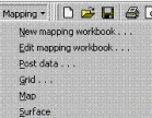
- Posts well locations with labels
- Interpolates parameter values to regular grid
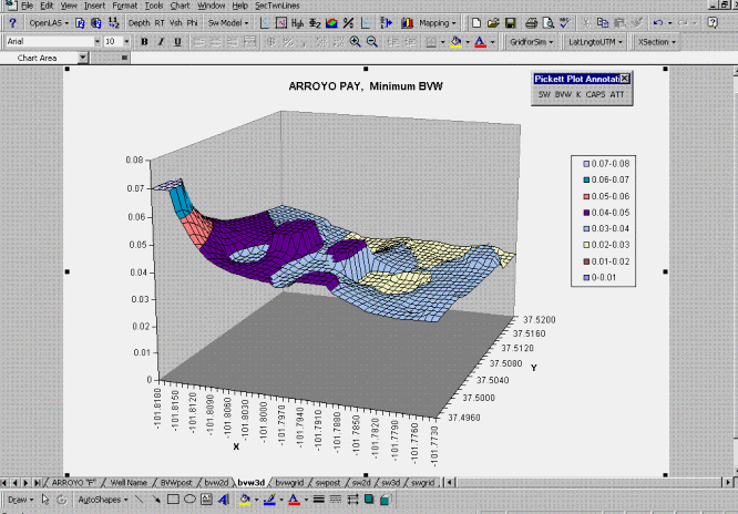
- Creates shaded contour or 3D surface representations of grids
Posting of Well Locations
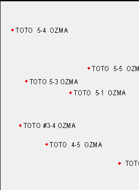
A Contour Map - an Excel Chart
3-D Maps - an Excel Chart