![]()
Prev Page--Abstract || Next Page--Geography
Introduction
Purpose and scope of the investigation
An extensive program of ground-water investigations in the western part of Kansas was initiated in 1937 by the State Geological Survey of Kansas and the Geological Survey, United States Department of the Interior, in cooperation with the Division of Sanitation of the Kansas State Board of Health, and the Division of Water Resources of the Kansas State Board of Agriculture. The first studies were made in the "Equus Beds" area of McPherson, Harvey and Sedgwick counties (Lohman and Frye, 1940) and in Ford County (Lohman, 1938). In 1939 investigations were made in several western counties that contain either extensive existing or potential ground-water developments for irrigation or some other special hydrologic features. Meade County, and especially the Meade artesian basin, was selected for early investigation because of the many flowing artesian wells that for years have attracted attention to this county. This report presents the results of a study made during a part of the summers of 1939 and 1940 to determine the availability, quantity, and quality of ground water in Meade County.
The investigation was made under the general supervision of R. C. Moore and K. K. Landes, state geologists, and O. E. Meinzer, geologist in charge of the Division of Ground Water of the Federal Geological Survey, and under the immediate supervision of S. W. Lohman, federal geologist in charge of ground-water investigations in Kansas.
Ground water is one of the principal natural resources of Meade County, hence there is a definite need for an adequate understanding of the quantity and quality of the available supply and what measures are necessary to safeguard its continuance. All public, railroad, and domestic supplies, and most of the stock supplies of the county are obtained from wells. In addition, ground water is being used to some extent for irrigation and it is quite possible that this use will increase in the future. Although at the present rate of withdrawal there appears to be little danger of seriously depleting the ground-water supply, the problem may become more acute as the number of large pumping plants increases.
Location and size of the area
Meade County, in southwestern Kansas, is in the fourth tier of counties east from the Colorado state line and lies immediately north of Oklahoma, as shown in figure 1. It lies between meridians 100° 4' and 100° 36' west longitude and parallels 37° 0' and 37° 29' north latitude. It has an area of about 974 square miles, is nearly square, and extends 30 miles east and west and about 32.5 miles north and south.
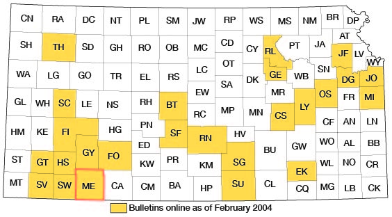
Figure 1--Index map of Kansas showing area described in this report and areas covered by other online geologic reports, as of Feb. 2004. For additional information, please visit the KGS Geologic Maps of Kansas Page.
Previous geologic and hydrologic work
The geology and hydrology of Meade County, and particularly the Meade artesian basin, attracted considerable attention during the closing years of the last century. Cragin (1891, 1896, 1897), Haworth (1896, 1897, 1897a, 1897b), and Johnson (1901, 1902) carried on field studies in this area, described and named some of the Tertiary and Quaternary deposits, and discussed the physiography, structure and ground water of the county. Following the early work of these men a period of years elapsed during which little work was done on the geology or hydrology of this part of the state. Two publications touching briefly on the hydrology of the area belong to this period, however--a water-supply paper by Parker (1911), and a report on well waters in Kansas by Haworth (1913).
During the last few years interest has been revived in the geology, vertebrate fossils, and ground water of the area. Hibbard (1938, 1939, 1939a, 1940, 1941, 1941a) spent the seasons of 1937 to 1941 collecting and studying vertebrate fossils of Meade County. Smith (1940) made a reconnaissance of the Cenozoic geology of southwestern Kansas, in which he placed considerable emphasis on this area. A preliminary report on the ground-water resources of the Meade artesian basin has been published (Frye, 1940), and Frye and Hibbard (1941) have summarized the stratigraphy and paleontology of the area.
Methods of investigation
The months of July, August and September, 1939, and the same months in 1940 were spent by me in Meade County collecting data for this report. During this time 354 wells were visited and the depth to water level or head and flow were measured. All measurements of the depth to water level were made with a steel tape from a fixed measuring point at the top of the well. The methods used in determining artesian pressures, or heads and flows, are described in a later section. Information regarding the nature and thickness of the water-bearing material, yield of the wells, and the use and general character of the water was obtained from many residents of the county. Samples of water were collected from 45 wells and chemical analyses of them were made by Robert H. Hess and Elza O. Holmes, chemists, in the Water and Sewage Laboratory of the Kansas State Board of Health.
Four test holes in 1939 and 20 test holes in 1940 were drilled by Ellis D. Gordon, Perry McNally, Fred T. Holden (1939 only), and Laurence P. Buck (1940 only), using a portable hydraulic-rotary drilling machine owned by the State and Federal Geological Surveys. The altitude of the land surface at the sites of the test holes and the altitude of the measuring points of about half of the wells visited were determined by Pierson Lyon, F. S. Bradshaw and assistants, through a cooperative arrangement with the Topographic Branch of the Federal Geological Survey.
The geology of the county was studied by me in conjunction with C. W. Hibbard, S. L. Schoff, Frank Byrne and H. T. U. Smith, and a geologic map of the county (Pl. 1) was prepared. Logs and samples obtained from the test holes supplemented surface studies and supplied invaluable data as to the subsurface character, thickness and extent of the deposits.
A map of the county compiled by the State Highway Department was used as a base map in preparing plates 1 and 2. The drainage was corrected from aerial photographs obtained from the United States Department of Agriculture, Agricultural Adjustment Administration.
Acknowledgments
Thanks and appreciation are expressed to the many residents of Meade County who supplied information and aided in the collection of field data. Special thanks are due to William Sourbeer, who drilled many of the early wells in the artesian basin and who supplied much of the historical data for this report, and to J. E. McCohn, formerly county agent, and R. S. Kirk, formerly county engineer, for their helpful advice. George S. Knapp, chief engineer of the Division of Water Resources, Kansas State Board of Agriculture, supplied measurements of artesian pressure made under his supervision in this area in 1923. These data have proven to be of much value. Thanks are also extended to Claude W. Hibbard and H. T. U. Smith, of the University of Kansas, and the several members of the Federal and State Geological Surveys who have offered valuable suggestions and criticisms.
The manuscript for this report has been critically reviewed by S. W. Lohman, O. E. Meinzer, and W. D. Collins of the Federal Geological Survey; R. C. Moore, state geologist, and Thomas Payne, editor, State Geological Survey of Kansas; George S. Knapp, chief engineer of the Division of Water Resources of the Kansas State Board of Agriculture; and Lewis Young, acting director of the Division of Sanitation of the Kansas State Board of Health. The illustrations were drawn by G. W. Reimer.
Prev Page--Abstract || Next Page--Geography
Kansas Geological Survey, Geologic History of Kansas
Comments to webadmin@kgs.ku.edu
Web version February 2004. Original publication date Dec. 1942.
URL=http://www.kgs.ku.edu/General/Geology/Meade/03_intro.html