![]()
Back to the Ogallala Formation...
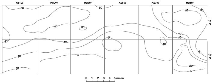
Figure 18
Figure 18--Saturated thickness of Tertiary and Quaternary deposits in Gove County. Contour interval 20 feet.
Back to the Ogallala Formation...
Kansas Geological Survey, Geology
Placed on web Sept. 30, 2008; originally published June 1960.
Comments to webadmin@kgs.ku.edu
The URL for this page is http://www.kgs.ku.edu/General/Geology/Gove/fig18.html