Wyandotte County
|
|
Wyandotte County |
|
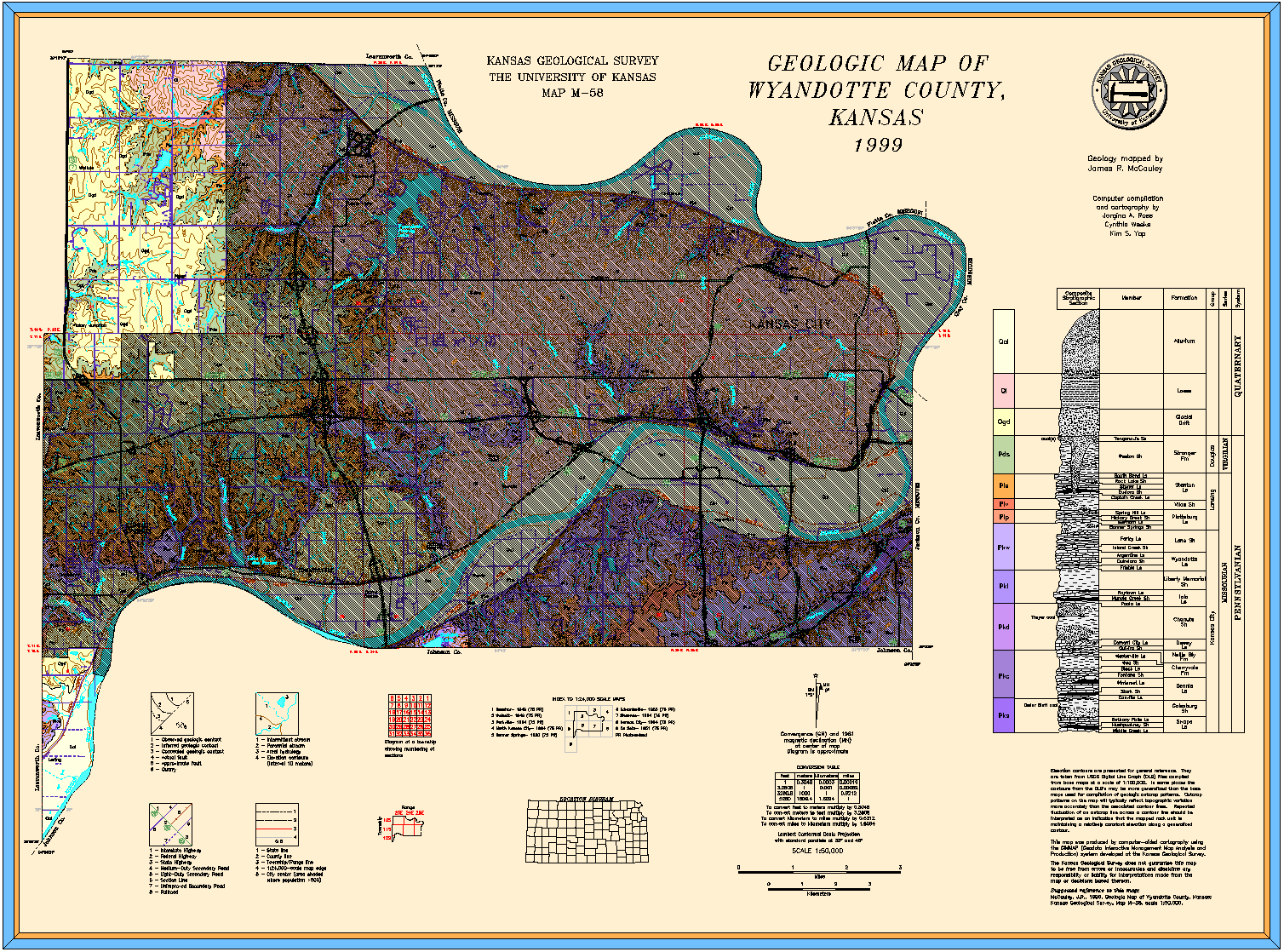
McCauley, J.R., 1999, Geologic map of Wyandotte County, Kansas: Kansas Geological Survey, Map M-58, scale 1:50,000, 30 x 22 inches
Paper copies of the complete map (with stratigraphic column and legend info) can be purchased from the Kansas Geological Survey, 1930 Constant Ave., Lawrence, KS 66047 (or phone 785-864-3965) and at 4150 W. Monroe St., Wichita, KS 67209-2640 (phone 316-943-2343).
Jewett, J.M., and Newell, N.D., 1935, The geology of Wyandotte County, Kansas: Kansas Geological Survey, Bulletin 21, pt. 2, pp. 151-205 (out of print, available online)
Fishel, V.C., 1948, Ground-water resources of the Kansas City, Kansas, area, with analyses by H.A. Stoltenberg: Kansas Geological Survey, Bulletin 71, 109 p. (out of print, [available online] )