


Dakota Aquifer Program--Subsurface Hydrology
Optical-fiber temperature logging
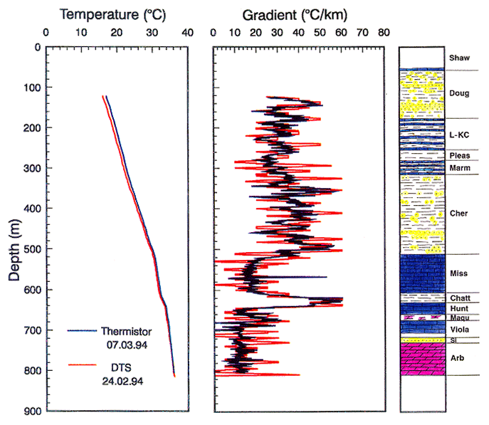
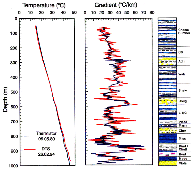
Figure 1
Figure 1. Plots of temperature and geothermal gradient
versus depth as obtained by the different logging devices in two boreholes.
DTS data are in red, conventional log is in blue. Data are plotted at 1 m
intervals with gradients smoothed by 2 m running average: A, Smokyhill
borehole; B, Big Springs borehole. Major stratigraphic units and their
lithology (lithologic symbols standard) are shown.
Use the "Back" command of your browser to return to the page you were viewing.
Dakota Home ||
Start of Hydrology Section
Kansas Geological Survey, Dakota Aquifer Program
Updated Sept. 30, 1996
Scientific comments to P. Allen Macfarlane
Web comments to webadmin@kgs.ku.edu
URL=http://www.kgs.ku.edu/Dakota/vol1/hydro/DTSfig1.htm