


Dakota Aquifer Program--Geologic Framework
Hodgeman County Study, Figure 6
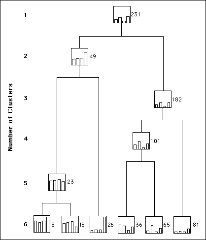
Figure 6. Final portion of the Ward's method tree for the
training set of the case study. The horizontal axis does not have a scale
and the boxes are bar diagrams for the coordinates of the centroids in a
vertical scale 0-150 ft.
Please use the "Back" command of your browser to return to the page you were viewing.
Dakota Home ||
a href="hodge1.htm">Start of Hodgeman County Study
Kansas Geological Survey, Dakota Aquifer Program
Updated Sept. 16, 1996.
Scientific comments to P. Allen Macfarlane
Web comments to webadmin@kgs.ku.edu
The URL for this page is HTTP://www.kgs.ku.edu/Dakota/vol1/geo/hodFig6.htm