


|


|
Region: Northern Midcontinent
System: Pennsylvanian
Upper Desmoinesian--Province Summary
This Upper Desmoinesian Play information is from the
U. S. Geological Survey
1995 National Assessment of United States Oil and Gas Resources (available
on CD-ROM from the U.S.G.S. as Digital Data Series DDS-30, Release 2).
|
Upper Desmoinesian Oil and Gas Play
by Mitchell E. Henry and Timothy C. Hester
The Upper Desmoinesian Oil and Gas Play contains mostly limestone
reservoirs, and consists of all Upper Desmoinesian Marmaton Group
strata, including those correlative units in the Middle Pennsylvanian
Deese Group. The upper boundary of this play is the top of the
Desmoinesian. The play extends throughout the province except that part
at the southern boundary where Desmoinesian strata are apparently
absent. Depths range from 3,500 ft at the top of the Marmaton Group on
the northern shelf to near 13,000 ft at its base near the Wichita
Mountains front. The predominance of limestone reservoirs is the
principal defining feature of this play.
Reservoirs
Reservoirs consist of undifferentiated Marmaton Group strata, and the
upper part of the Deese Group, including the Oswego lime, and the
Gibson, Glover, and Culberson sands. The Marmaton Group consists
primarily of limestone with thin shale beds in the northern Oklahoma and
Kansas portion of the play (Bingham, 1993) but it contains mostly
terrigenous clastics to the south (Moore, 1979). Marmaton rocks range
in thickness from about 175 ft in the northernmost part of the province
to an estimated 1,700 ft at the southern play boundary. Porosity of
productive Marmaton strata ranges from 2 to almost 18 percent.
Source rocks
Source rocks for this play may be the Marmaton shales (or other
Pennsylvanian shales) in the deeper, more thermally mature parts of the
basin. South of the Kansas-Oklahoma border, all of these potential
source rocks have probably reached the thermal zone of oil generation
(Schmoker, 1989). The mixed types of produced hydrocarbons suggest a
mixture of kerogen types in the source rock. Other source rock
qualities of Middle and Upper Pennsylvanian shales are discussed in
Lower Desmoinesian Stratigraphic Gas and Oil Play.
Timing and migration
Past success in this play indicates favorable timing of generation and
migration of hydrocarbons and trap formation. Hydrocarbon generation
probably began as early as 250 Ma in the deeper parts of the play. Most
major accumulations occur in the area of thermally mature Marmaton
strata and are concentrated near the Oklahoma and Texas Panhandles.
Reservoirs in immature areas, located near the Central Kansas Uplift or
in west-central Kansas, were probably charged by long-distance migration
(Burruss and Hatch, 1989).
Traps
Structural traps resulting from anticlines and structural noses are most
common in this play. Seals are formed by interbedded Pennsylvanian
shales. Fifty-two major accumulations are assigned to this play, 38 oil
and 14 gas. The largest oil accumulation is at Putnam field, with an
estimated ultimate recovery of 65 MMBO. The largest gas accumulation is
at South Lambert field, with an estimated ultimate recovery of 123 BCFG.
Exploration status and resource potential
This play is well explored. Wells reporting penetration of Marmaton
rocks number more than 40,000. The actual number is probably much
greater, perhaps 64,000 or more. Because of this high level of
exploration where structural influence is dominant, the potential for
major new discoveries seems rather low. Resource estimates are based
largely on historical production and well completion records.
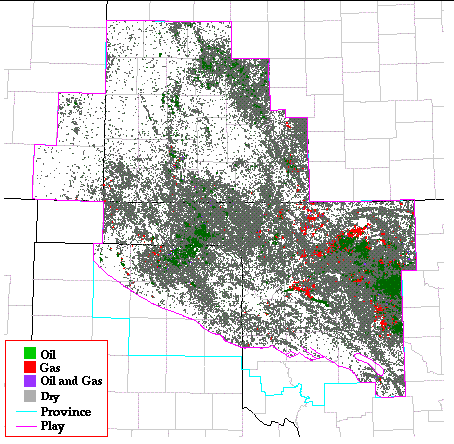
Play Map
References
Bingham, T.L., 1993, Desmoinesian fluvial-deltaic sandstone and
shallow-marine limestone--Anadarko basin, Oklahoma, in Debout,
D.G., White, W.A., Hentz, T.F., and Grasmick, M.K., Atlas of major
Midcontinent gas reservoirs: p. 33-35.
Burruss, R.C., and Hatch, J.R., 1989, Geochemistry of oils and
hydrocarbon source rocks, greater Anadarko basin--evidence for multiple
sources of oils and long-distance oil migration, in Johnson,
K.S., ed., Anadarko Basin Symposium, 1988: Oklahoma Geological Survey
Circular 90, p. 53-64.
Moore, G.E., 1979, Pennsylvanian paleogeography of the southern
Midcontinent, in Hyne, N.J., ed., Pennsylvanian sandstones of the
mid-continent: Tulsa Geological Society Special Publication no. 1, p.
2-12.
Schmoker, J.W., 1989, Thermal maturity of the Anadarko basin, in
Johnson, K.S., ed., Anadarko Basin Symposium, 1988: Oklahoma Geological
Survey Circular 90, p. 25-31.
Kansas Geological Survey, Digital Petroleum Atlas
Updated May 28, 1998
Comments to webadmin@kgs.ku.edu
URL=http://www.kgs.ku.edu/DPA/frontEnd/Anadarko/UpDesmo/provSum.html