Basin: Anadarko
County: Stevens County
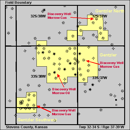
Gentzler Field
You can explore the Gentzler Field by clicking on the blue topic buttons to the left.Use the Field Site Map to learn what resources are available for the Gentzler Field.
|
| ||
|
|
Play: Morrow Basin: Anadarko County: Stevens County Gentzler FieldYou can explore the Gentzler Field by clicking on the blue topic buttons to the left.Use the Field Site Map to learn what resources are available for the Gentzler Field. |
|
|
Gentzler Field Discovery Well Anadarko Petroleum, #1 Gentzler "A" SW NE, 7-T33S-R37W 10/6/71, Morrow Gas, 6595' RTD
Anadarko Petroleum, #2 Davis "C"
Field Size: 12,160 acres
Gentzler North Field
Field Size: 3,200 acres
Gentzler Southwest Field
Field Size: 2,240 acres |