DPA Home Page DPA Kansas Page Site Map Help
General Field Info Field Geology Info Field Geophysics Info Field Reservoir Info Field Well Info 
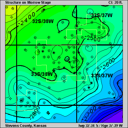
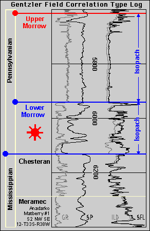
Play: Morrow
Basin: Anadarko
County: Stevens County

Gentzler Field

Clicking on the small blue circles or on the blue isopach labels on the stratigraphic column will take you to pages showing structure or isopach maps. You can also use the buttons at right to investigate the Gentzler area.
Local Site Map Next Page

Morrow structure map correlation type log


Kansas Geological Survey, Digital Petroleum Atlas
Send comments and/or suggestions to webadmin@kgs.ku.edu
Updated Sept. 19, 1996
URL = http://www.kgs.ku.edu/DPA/Gentzler/Geology/gentzlerGeol1.html