Basin:
Anadarko
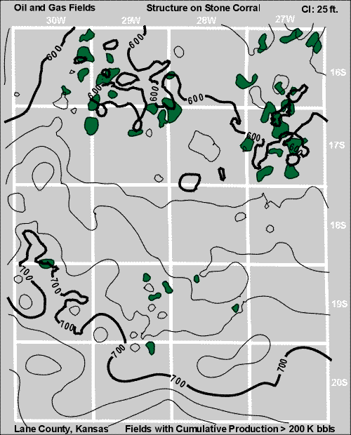
Lane County
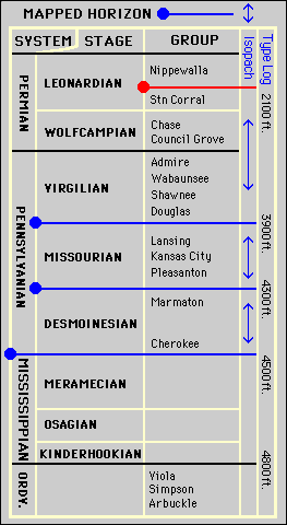
Clicking on the small blue circles or blue arrows on the stratigraphic column will take you to pages showing structure or isopach maps. You can also use the "Next" and "Prev" buttons at left to investigate Lane County.
Kansas Geological Survey
, Digital Petroleum Atlas
Comments to
webadmin@kgs.ku.edu
Updated Nov. 26, 1997
URL = http://www.kgs.ku.edu/DPA/County/klm/lane2.html