Basin: Anadarko
County: Stanton County
Arroyo Field
You can explore the Arroyo Field by clicking on the blue topic buttons to the left.Use the Field Site Map to learn what resources are available for the Arroyo Field.
|
| ||
|
|
Play: Morrow Basin: Anadarko County: Stanton County Arroyo FieldYou can explore the Arroyo Field by clicking on the blue topic buttons to the left.Use the Field Site Map to learn what resources are available for the Arroyo Field. |
|
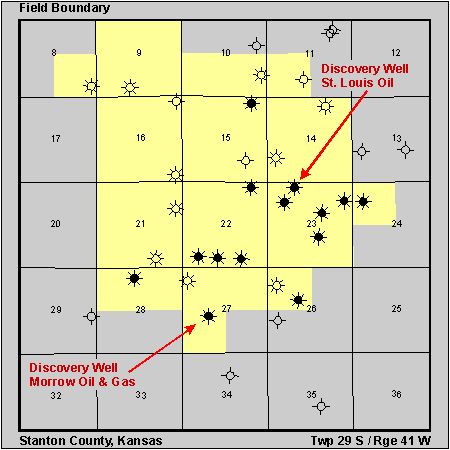 Discovery Well
J.M. Huber, #27-1 Pro Farms
20'S NW NE SW, 27-T29S-R41W
04/12/90, Morrow Oil and Gas, 5900' RTD
J.M. Huber, #23-1 Kendrick
30'E NW NE NW, 23-T29S-R41W
06/23/92, St. Louis Oil, 5650' RTD
Field Size: 6,240 acres
Productive Wells: 24
Abandoned Wells: None
Cumulative Oil: 651,409 bbls as of 7/1/95
Cumulative Gas: 21,072,705 mcf as of 7/1/95