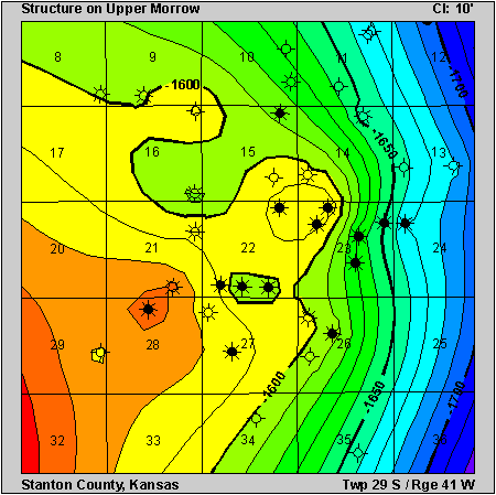
Basin: Anadarko
County: Stanton County
Arroyo Field
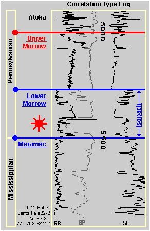
Clicking on the stratigraphic column will take you to pages showing structure or isopach maps.You can also use the buttons at right.
|
| ||
|
|
Play: Morrow Basin: Anadarko County: Stanton County Arroyo FieldClicking on the stratigraphic column will take you to pages showing structure or isopach maps.You can also use the buttons at right. |
|