Kansas Geological Survey, Current Research in Earth Sciences, Bulletin 244,
part 3
The Relationship Between Geology and Landslide Hazards of Atchison, Kansas, and Vicinity--Fig. 8
![]()
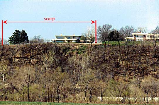
Fig. 8. A recent landslide along Riverview Drive south of downtown Atchison (SW NE sec. 7, T. 6 S., R. 21 E.). The scarp (the surface break at the top of the landslide) is along the road at the top of the hill, and the toe (where material piles up at the bottom of the landslide) is at the base of the slope. The houses in the photograph are set back from the top of the hill and are not currently involved in the landslide.