Kansas Geological Survey, Current Research in Earth Sciences, Bulletin 241,
part 2
Distribution of the Bandera Shale of the Marmaton Group, Middle Pennsylvanian of Southeastern Kansas--fig. 9
![]()
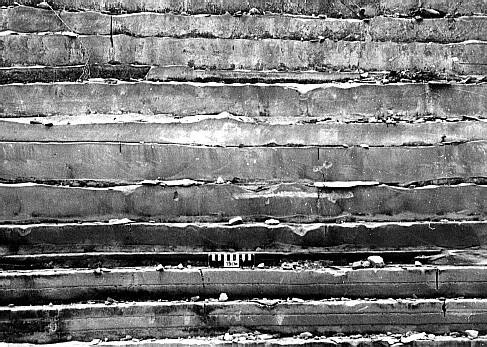
Fig. 9A. Sedimentary features in the Bandera Sandstone quarry, Bourbon County, Kansas. Interbedded sandstone and shale about 2 m (6.6 ft) above base of Bandera Sandstone quarry section; scale is 15 cm (5.9 in).
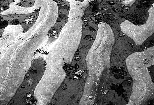
Fig. 9B. Sedimentary features in the Bandera Sandstone quarry, Bourbon County, Kansas. Regularly spaced ripple crests on bedding planes 0.5 m (1.6 ft) above base of Bandera Sandstone quarry section; scale is 15 cm (5.9 in).
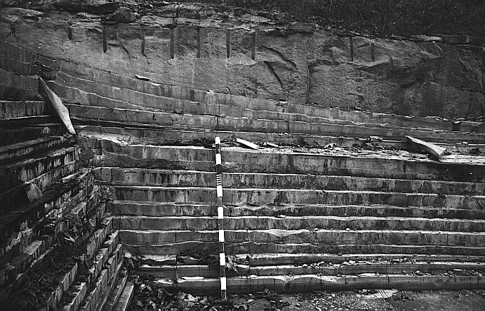
Fig. 9C. Sedimentary features in the Bandera Sandstone quarry, Bourbon County, Kansas. Dune feature loading down into interbedded sandstone and shale, 3.2 m (10.5 ft) above base of Bandera Sandstone quarry section; rod is 1.5 m (4.9 ft) long.
![]()
Kansas Geological Survey
Web version June 24, 1998
http://www.kgs.ku.edu/Current/1998/brownfield/fig9.html
email:lbrosius@kgs.ku.edu