Kansas Geological Survey, Current Research in Earth Sciences, Bulletin 241,
part 2
Distribution of the Bandera Shale of the Marmaton Group, Middle Pennsylvanian of Southeastern Kansas--fig. 8
![]()
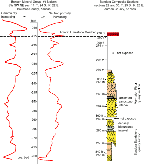
Figure 8. Comparison between well-log signatures and a composite surface section from the Bandera quarry in Bourbon County, Kansas. Depths on the well log are measured from the drill rig's Kelly Bushing and are approximately equivalent to depth below the surface. Elevations above sea level are shown on the composite section. See fig. 3 for location of surface section.
![]()
Kansas Geological Survey
Web version June 24, 1998
http://www.kgs.ku.edu/Current/1998/brownfield/fig8.html
email:lbrosius@kgs.ku.edu