Kansas Geological Survey, Current Research in Earth Sciences, Bulletin 241,
part 2
Distribution of the Bandera Shale of the Marmaton Group, Middle Pennsylvanian of Southeastern Kansas--fig. 7
![]()
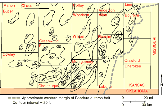
Fig. 7. Sandstone isolith map of the Bandera Shale show concentrations of sandstone units in northeast-southwest orientation, with highest sandstone content in the southeastern portion of study area. Dashed line represents western margin of Bandera outcrop belt. Contour interval = 20 ft (6.1 m).
![]()
Kansas Geological Survey
Web version June 24, 1998
http://www.kgs.ku.edu/Current/1998/brownfield/fig7.html
email:lbrosius@kgs.ku.edu