![]()
The study area (fig. 1) is along the eastern flank of the Western Interior basin (Schenk, 1967), including the north portion of the Cherokee basin, south of the Bourbon arch. The Nemaha uplift separates the Cherokee basin from the Sedgwick basin of south-central Kansas. To the south, the Cherokee basin extends to the Arbuckle Mountains in south-central Oklahoma.
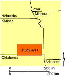
Fig. 1. Location of study area in southeastern Kansas.
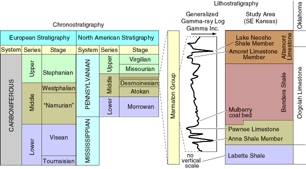
Fig. 2. Stratigraphic terminology for the Marmaton Group in southeastern Kansas and chronostratigraphic relations with North American and European scales. Chronostratigraphic relationships between Europe and North America came from COSUNA stratigraphic correlation charts (Salvador, 1985, fig. 1, p. 182). Generalized gamma-ray log illustrates typical signatures for the portion of the Marmaton Group studied.
According to Zeller (1968, p. 26), the Bandera Shale is a "mainly nonmarine gray and yellow, mostly blocky claystone, well bedded shale, and massive to thin-bedded sandstone. Maroon bands are present in the upper part." The formation contains limonite concretions and veins, with septarian limestone concretions present locally, and in the lower part, north of Crawford County, the Mulberry coal bed is persistent. Shale below the coal is light to dark gray and carbonaceous. Locally, a dark gray limestone, 6-9 ft (1.8-2.7 m) thick, lies just above the Mulberry coal beds (Zeller, 1968).
The strata between the Mulberry coal bed and the Pawnee Limestone consists of a blue-gray shale that grades upward into an underclay at the base of the coal (Whitla, 1940, p. 17). Carbonaceous remains of plant fragments are present in the underclay.
A very local coal bed near the top of the Bandera Shale in Labette County, Kansas, was reported by Jewett (1945, p. 36). The same or a similarly situated coal was observed 0.8 m (2.6 ft) below the base of the Amoret Limestone Member in the SE sec. 11, T. 35 S., R. 18 E., Labette County, Kansas, a few hundred meters north of the Oklahoma state line.
![]()
Kansas Geological Survey
Web version October 15, 1998
http://www.kgs.ku.edu/Current/1998/brownfield/brownfield2.html
email:lbrosius@kgs.ku.edu