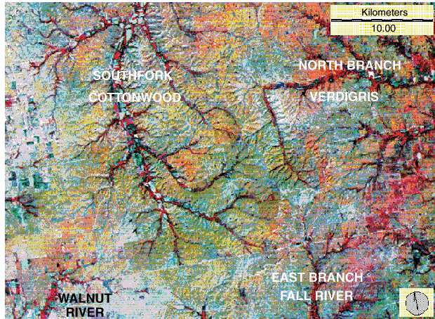
Fig. 13. Landsat multispectral scanner (MSS) image of central Flint Hills region in southern Chase, northwestern Greenwood, and northeastern Butler counties. Standard false-color composite, in which active vegetation appears pink and red. Vegetation is active within valleys, and Flint Hills uplands appear in green-orange colors in this autumn image from a drought year.
The abrupt change in direction of the upper North Branch Verdigris River is one of the most prominent drainage anomalies in Kansas. This anomaly is presumably a result of stream capture by the South Fork Cottonwood of the ancestral Verdigris. Note the alignment of headwaters for the North Branch Verdigris River and East Branch Fall River valleys. These two valleys are part of the Verdigris lineament trend at about 350° (Aber et al., 1997). Digital Landsat MSS data obtained from the EROS Data Center, U.S. Geological Survey.
![]()
Kansas Geological Survey
Web version March 18, 1998
http://www.kgs.ku.edu/Current/1997/aber/fig13.html
email:lbrosius@kgs.ku.edu