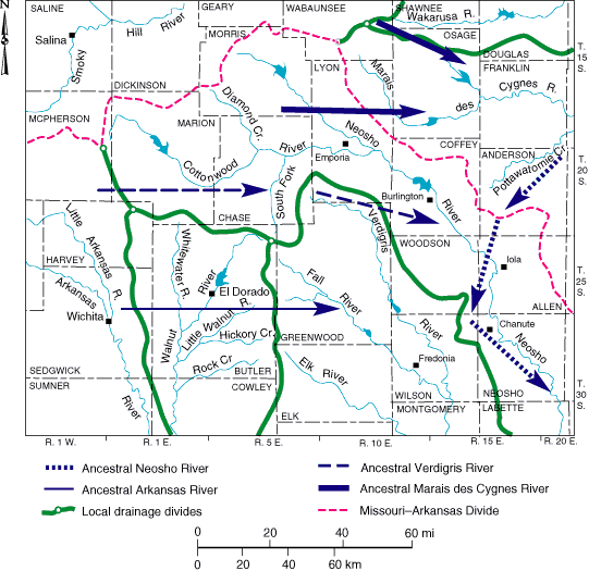
Fig. 2. Study area showing rivers, drainage divides, and ancestral drainage routes.
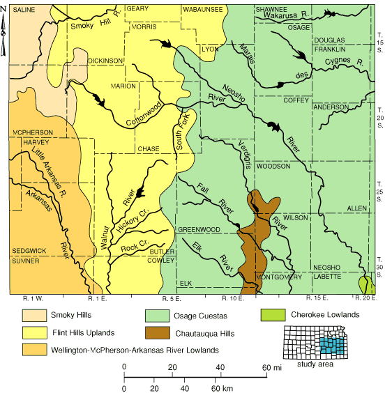
Fig. 3. Study area showing rivers and principle physiographic regions. In this study, the Arkansas River Lowlands and the Wellington-McPherson Lowlands are treated as one region.
The Flint Hills form an erosional massif that stands above lower plains to the east and west. The Flint Hills are underlain by lower Permian limestones, shales, and evaporites. Thick, cherty limestone units weather to produce residual lag deposits composed of angular chert fragments, which are highly resistant to chemical breakdown (fig. 4). Such residual chert is responsible for maintaining high topographic relief and gives the Flint Hills their name. The eastern margin of the Flint Hills is marked by a major escarpment that is especially prominent in northwestern Greenwood and eastern Chase and Butler counties. Divides between the Walnut and the Cottonwood, Verdigris, and Fall drainage basins follow the crest of the Flint Hills escarpment. Maximum elevations exceed 500 m (1,640 ft), relief is locally up to 100 m (330 ft), and stream valleys are deeply entrenched. From their eastern crest, the Flint Hills slope gently westward, down the regional bedrock dip, toward the eastern limit of the Wellington-McPherson-Arkansas River Lowlands.
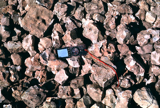
Fig. 4. Close-up view of angular chert blocks in gravel pit. Compass for scale.
The Arkansas drainage divide marks a major boundary in the geomorphology of central Kansas. To the west, the Wellington-McPherson-Arkansas River Lowlands form a nearly flat plain that slopes imperceptibly toward the south. It is underlain by unconsolidated Neogene and Quaternary sediments of arkosic composition and variable thicknesses. These sediments were derived from the west and deposited on a wide alluvial plain. The upper surface of the lowland is little modified by subsequent erosion. However, its eastern and northern margins are locally truncated by headward erosion of tributaries within the Walnut, Cottonwood, and Smoky Hill drainage systems.
The Osage Cuestas and Chautuaqua Hills are generally lower in elevation and relief compared to the Flint Hills. Elevations are mostly in the 250 m to 350 m (820-1,150 ft) range. Upper Pennsylvanian shale and poorly consolidated sandstone underlie most of these regions. Thick limestone units are more resistant to erosion and support conspicuous escarpments, where local relief may reach 50 m (160 ft). Elevations exceeding 360 m (1,180 ft) are found on the Missouri-Arkansas drainage divide in central Anderson County. Chert is relatively scarce within upper Pennsylvanian bedrock throughout eastern Kansas.
![]()
Kansas Geological Survey
Web version March 18, 1998
http://www.kgs.ku.edu/Current/1997/aber/aber3.html
email:lbrosius@kgs.ku.edu